Case Studies:

WEBCOR RELIES ON DRONE PHOTOGRAPHY & UAV MAPPING TO KEEP A MASSIVE P3 PROJECT ON TRACK

How Multivista-Captured Aerial Data Kept Everyone Informed on the Astoundingly Complex Merced 2020 Job Site

The professionals at Webcor have led massive projects throughout California, including the Oracle World Headquarters, George R. Moscone Convention Center, Zuckerberg San Francisco General Hospital, the San Francisco Museum of Modern Art expansion, and Metropolis Los Angeles.

Webcor takes sustainability seriously. In 2013, Webcor became the first California-based general contractor to have its quality management systems certified against the ISO 9001 quality standards. Their team are experts at building LEED certified structures. In fact, every one of the 14 new building structures on the $1.4b Merced 2020 project, which broke ground in October of 2016, will be LEED Gold certified.

PROJECT SUMMARY

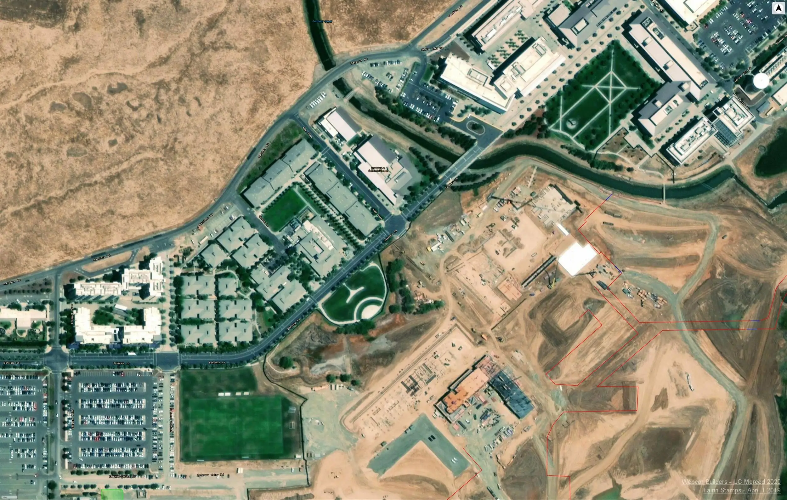
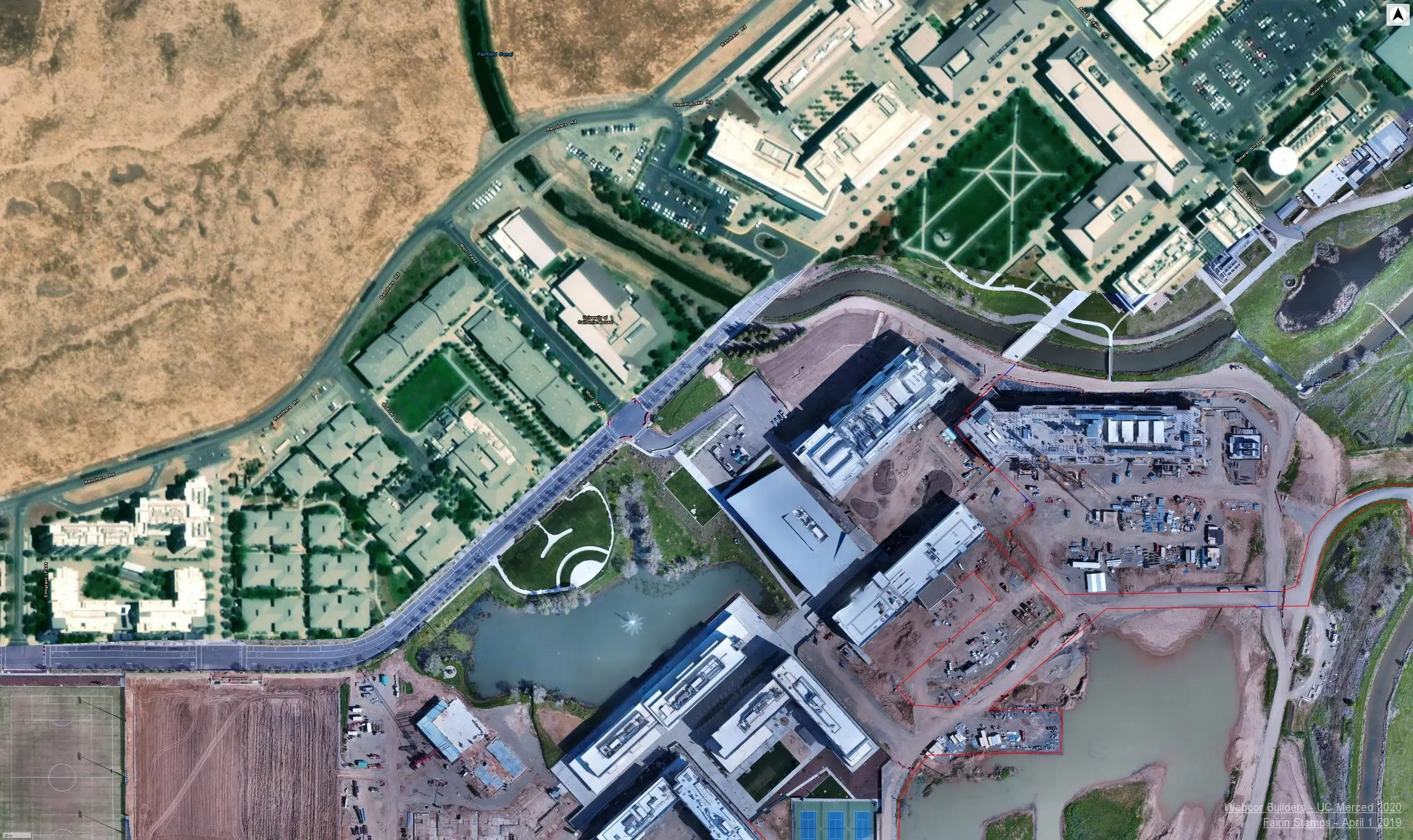
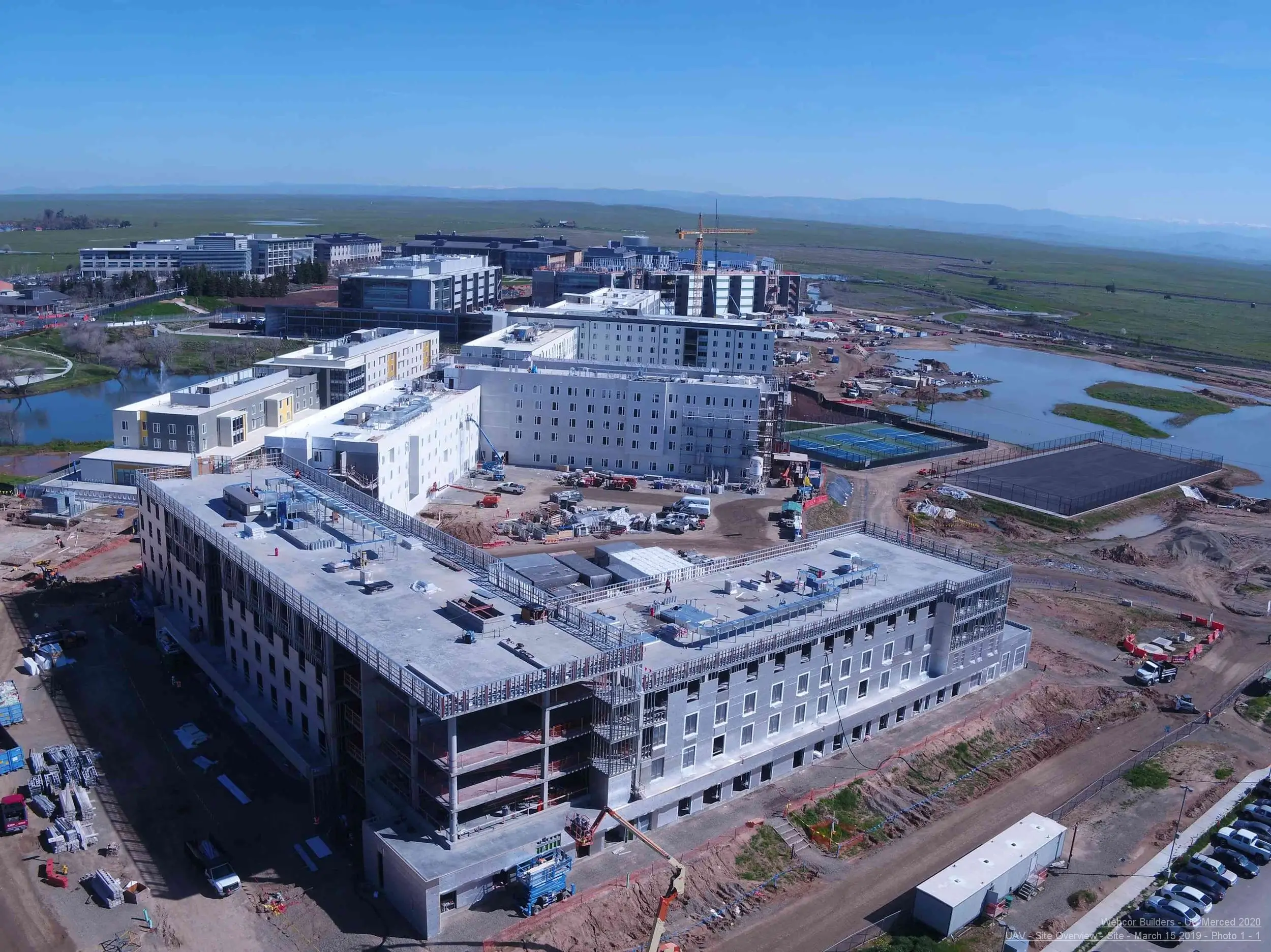
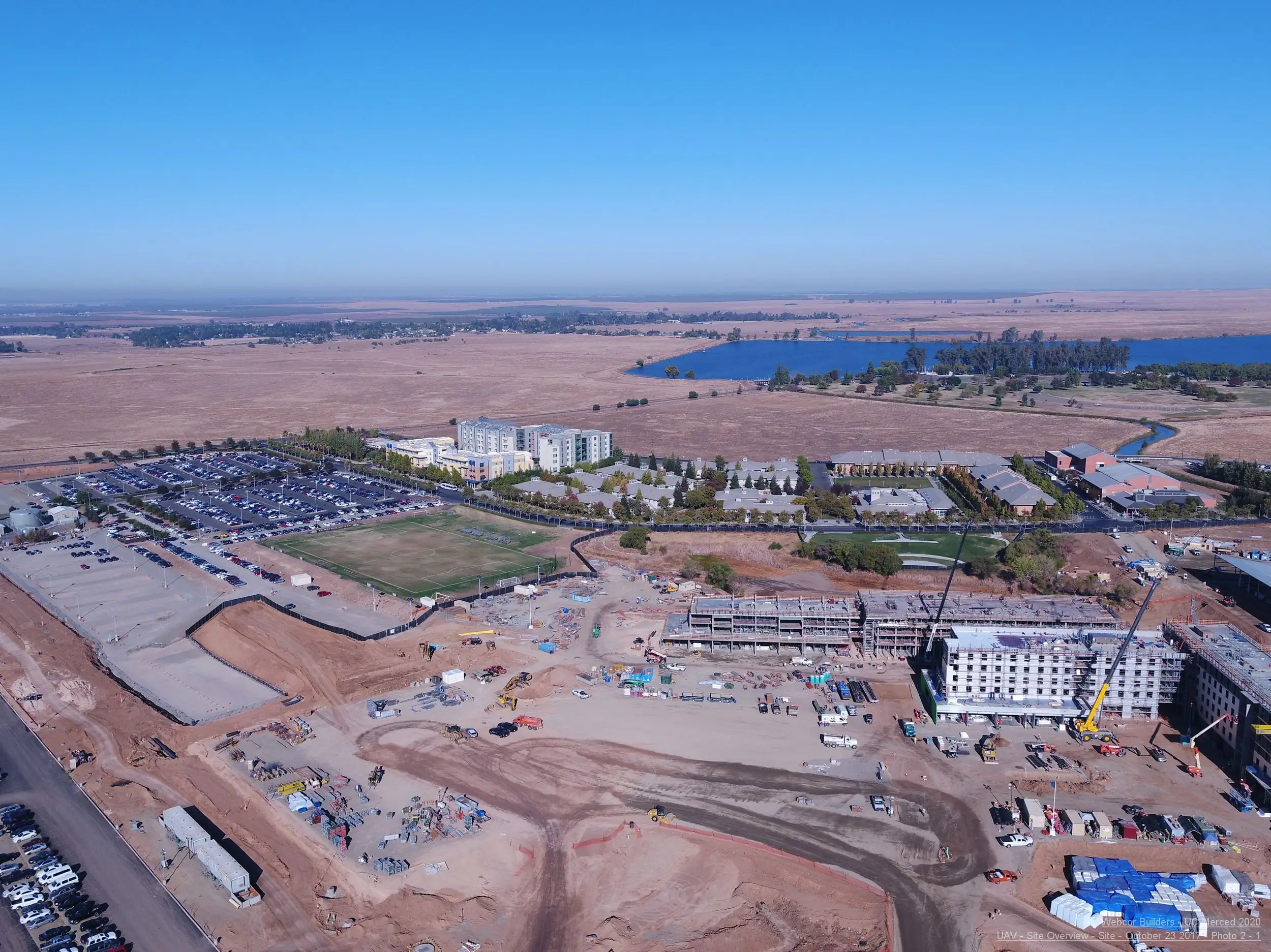
In order to meet the needs of a rapidly growing student body, the University of California Merced is almost doubling its footprint, adding 1.2 million GSF of new development including residential space for 1,700 beds, 3,500 parking spaces, a competition pool, wet, dry, and computation labs, a hazmat building, research server complex, three new playing fields, two bridges, a dining facility, and a transit center.

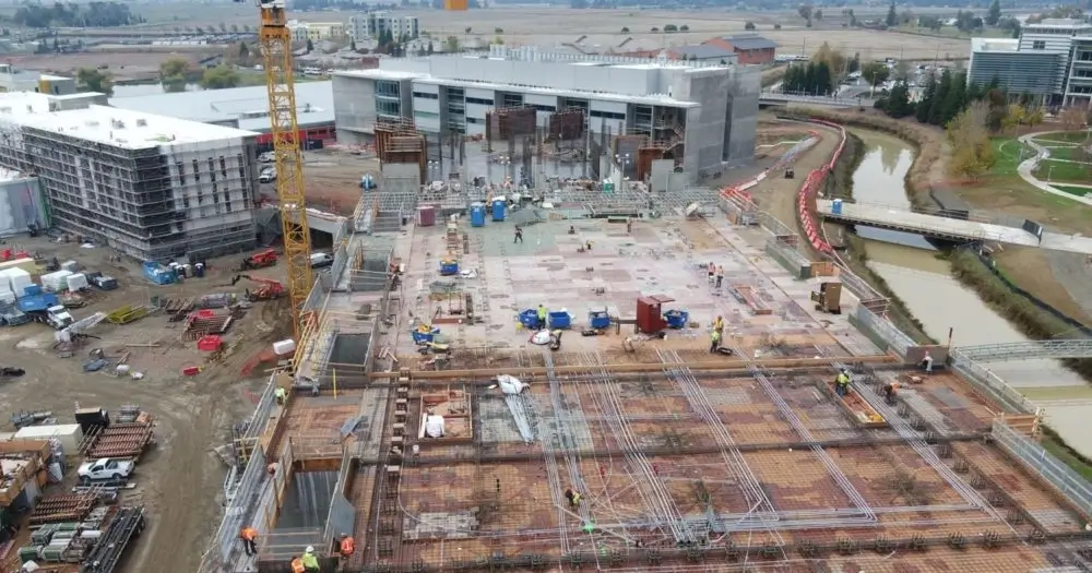
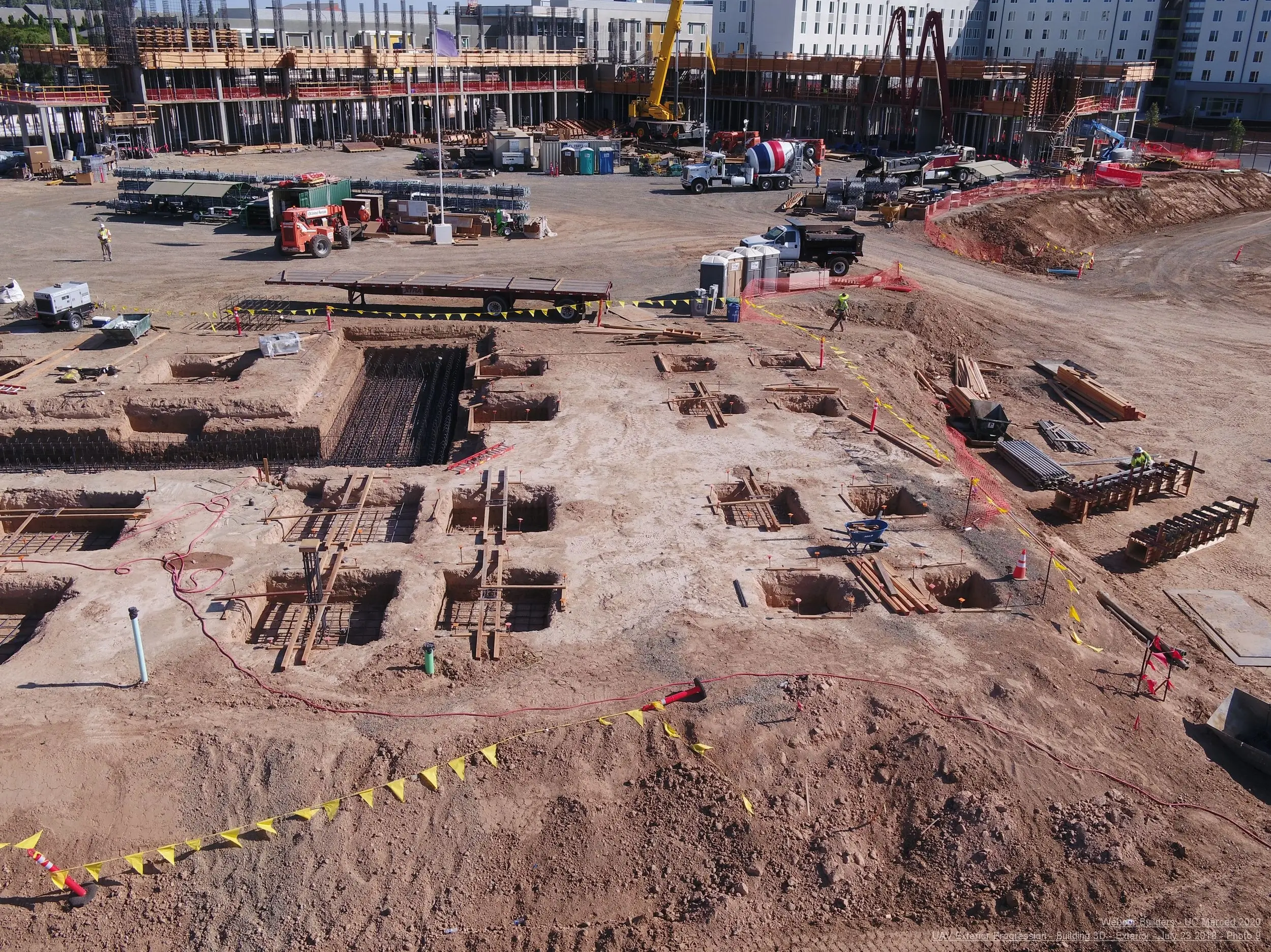
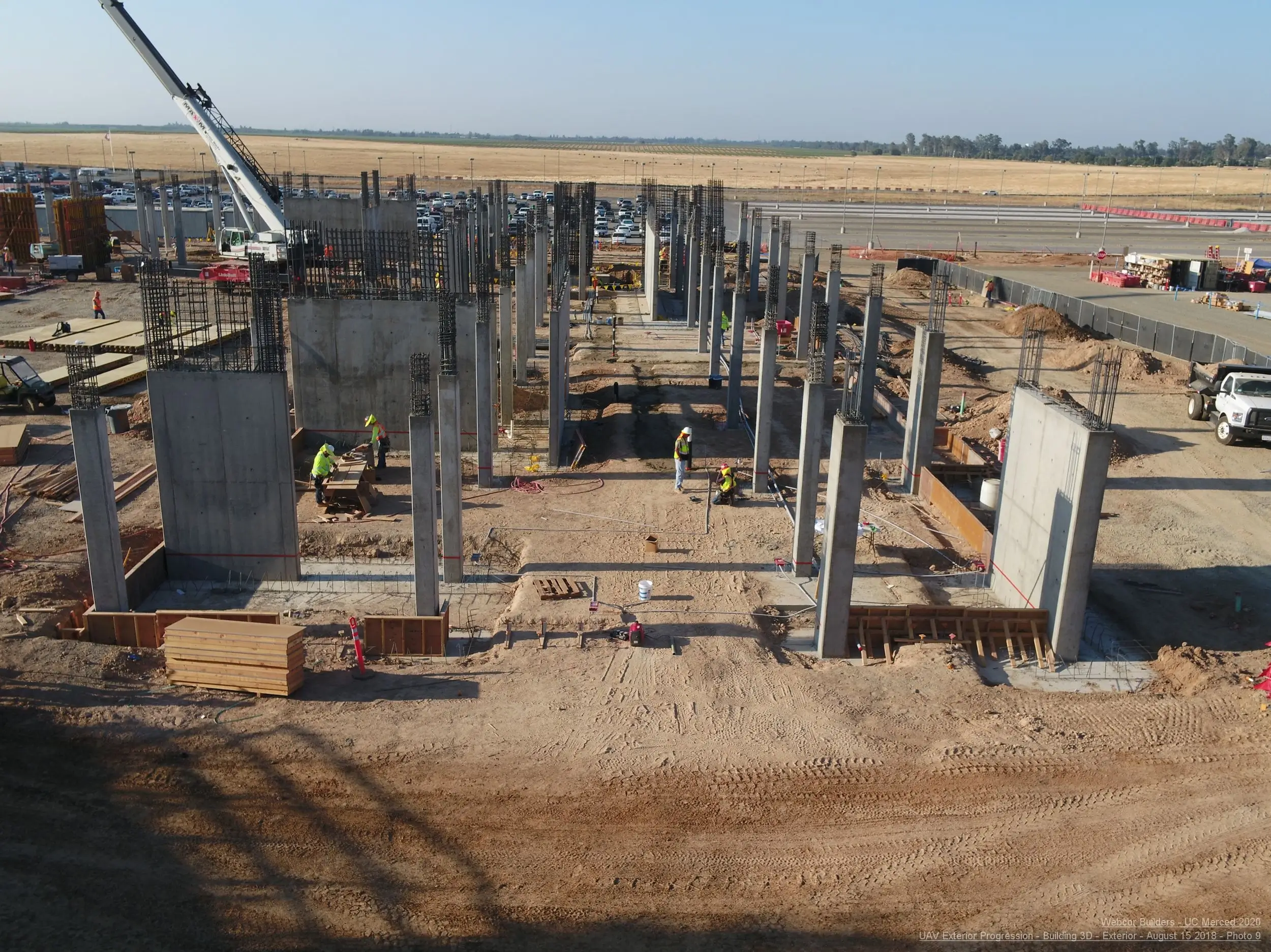
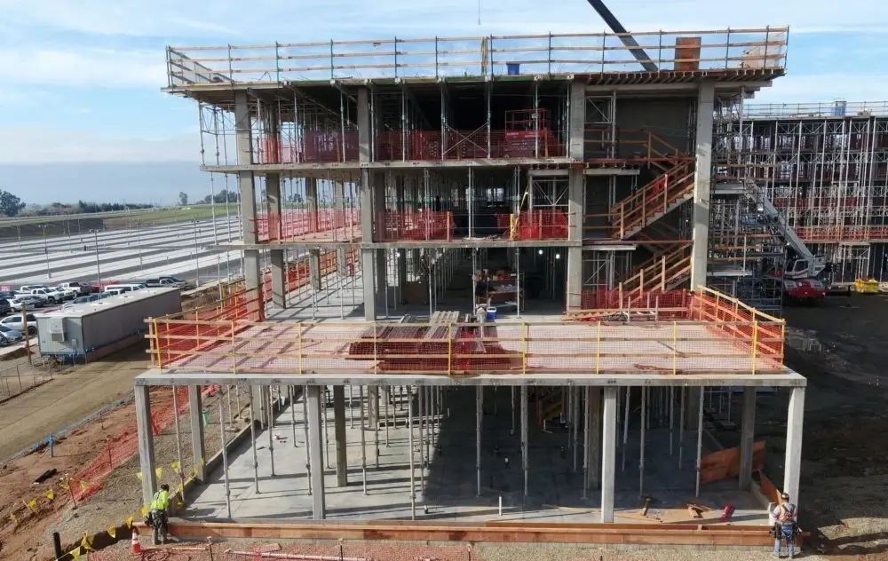
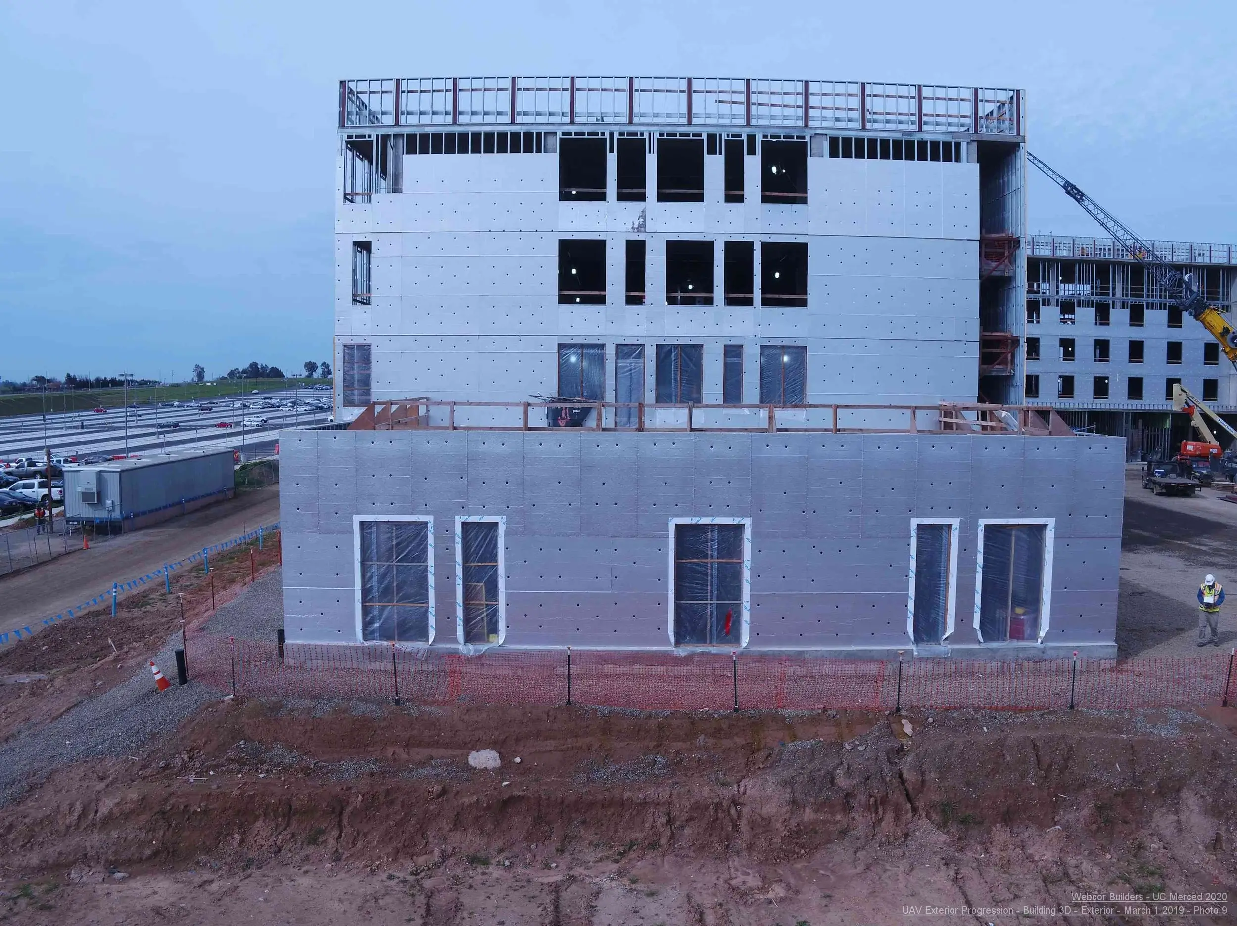
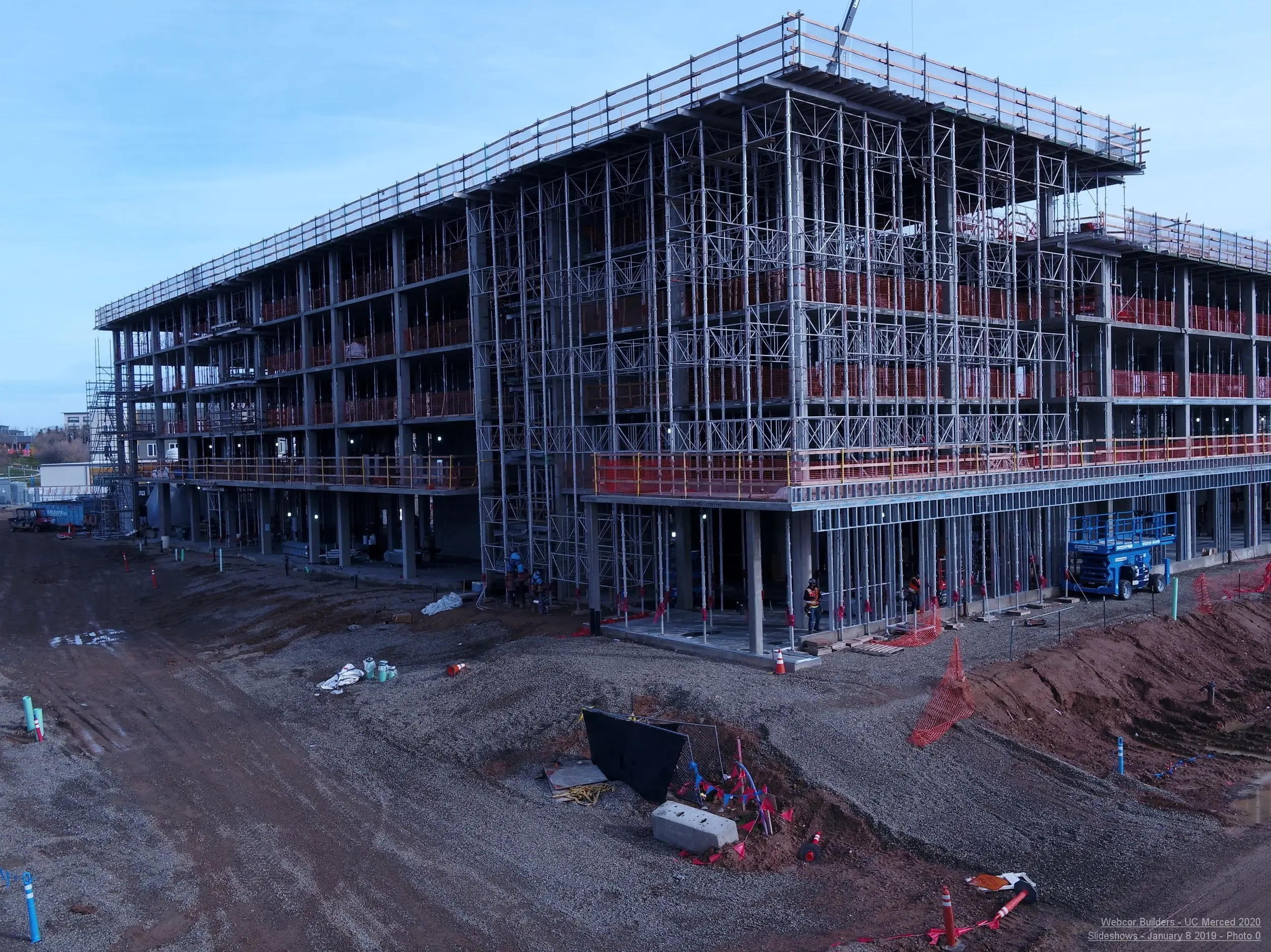
As the lead contractor on the Merced 2020 project, Webcor had their work cut out for them from the beginning. With seven engineering firms and five architectural firms involved in the design of the 14 new campus buildings across the 219-acre-site, keeping everyone apprised of the conditions throughout the entire site was a massive challenge. Site Superintendent, Lucky Luchsinger, knew that aerial UAV photography was going to be critical on this expansive project — but exactly how it fit in wasn’t clear from the start.

CHALLENGE #1 Creating A Point Of Reference

With such an expansive job site being crisscrossed by hundreds of team members each day, comprehensive top-down visibility was a requirement from day one. Keeping track of what work had been completed, where equipment and materials were stored, and what areas were ready to be worked on next was key to working efficiently and ensuring on-time and on-budget delivery.

Initially, Webcor deployed their own UAV to handle aerial progress photography. However, they quickly found that this automated UAV solution lacked the flexibility and consistency desired, left important stakeholders in the dark because of segmented or corrupted data, and tied up valuable resources.

Multivista, was contracted to take that load off the project team. With a team of experienced UAV pilots on the ground and a full support team in the back office, Multivista captured the bi-weekly aerial documentation Webcor needed to help keep Merced 2020 on its critical path.

CHALLENGE #2 Connecting Remote Stakeholders

As with any P3 (public private partnership) project, there are stakeholders from both sides of the public/private divide who need to be kept up to date on progress. Beyond the usual oversight, the presence of 12 architecture and engineering firms, five design-build partners, plus over 100 suppliers and contractors, UC Merced stakeholders, and more meant that everyone would need a reliable way to stay updated on progress from remote locations.

To date, Webcor has provided Multivista project access to nearly 150 project stakeholders throughout 30 companies. With each stakeholder able to access up-to-date aerial imagery, the project team is able to review progress, reference as-built conditions, and verify that work has been completed from anywhere.

Because of the size of the project, the build started even while some design stages were underway. To save time and avoid unnecessary drawing revisions of areas that were already constructed, Luchsinger directed each design firm to review the project’s most recent visual documentation to determine the construction stage and verify whether changes could be made without additional delays.

All parties were also able to check on-site materials and progress, creating a culture of transparency that led to greater accountability.

CHALLENGE #3 | Billing Verification for the Client

One of the most time-consuming aspects of a large construction project like Merced 2020 is managing the billing process. Nobody wants to pay for work that hasn’t been completed correctly, but verification requires visiting the site to regularly inspect progress. These visits can be difficult to schedule and manage, and can slow down the billing process.

With regularly updated aerial photography from Multivista, billing becomes a whole lot easier. When the client needs to verify work against an invoice, they can log in and check the most recent photos to see for themselves that the work has been completed. That means no time-consuming site visits, faster remittance of payment, and a smoother and more efficient project.

Visibility For All

50,000+Images captured and linked to interactive floorplans

23Progressive aerial site-maps created

148+Stakeholders accessing data from 30 organizations

500+Workers on site each day

CONCLUSION

Projects of the magnitude of Merced 2020 typically face cost overruns and delays, often because of information silos and a general lack of transparency between the many different parties involved. Luchsinger, and the forward-thinking team at Webcor, has proven that these kinds of problems aren’t inevitable — they can be avoided through transparency, open communication, and a comprehensive view of project progress.

Webcor has given considerable access to a wide array of stakeholders (even those who are unable to easily visit the site) in order to empower agile, informed decision making. That team has leveraged Multivista’s UAV-captured aerial photography to power efficient scheduling, on-site material verification, QA/QC, site logistics, and serve as a daily reference point for the entire project.

Now over 2 million labor-hours in, Merced 2020 remains on schedule and on budget two phases into the three-phase project, a feat which is virtually unheard of with an undertaking of this scale. That means greater education opportunities are coming to UC Merced students today and in the future.

Multivista Services Used:

  • UAV Site Mapping
  • UAV Exterior Progression Images
  • UAV Roof Progression
  • UAV Elevation/Waterproofing Images
  • Aerial Video Flyovers


REQUEST A QUOTE

REQUEST A QUOTE FOR PROGRESS PHOTOGRAPHY OR OTHER DOCUMENTATION SERVICES BELOW