
We understand your 3D scanning requirements
Over the past decade, Multivista has documented +300 million square feet of 3D scanning projects for +2700 architects, general contractors, and developers worldwide.
Unlike other providers, we have 150+ local laser scanning experts on the ground in +500 cities to advise you on the best service to suit your needs, inform you about timelines and processes.
As part of the Hexagon family, we work closely with our sister companies like Leica Geosystems giving us access and insight into the latest in reality capture technology.
With a +20 year track record in the construction reality capture industry, we have the experience to meet your expectations, and surpass them.
+2,000
Scanning Projects / Year
+1,000
Scan to Services Projects / Year
A GLOBAL Trusted 3D scanning provider

Our local Multivista teams provide expert services in 3D laser scanning and scan to services. With a vast knowledge and experience, our teams can advise on best practices and methods to effectively digitize your as-built environment to meet your project requirements and solve costly problems.
Thousands of clients worldwide, ranging from small businesses to Fortune 500 companies and government entities, have placed their trust in Multivista to provide 3D scanning services for a variety of use cases.
- Renovation and refurbishment
- Pre-slab & MEP documentation
- Construction verification
- Floor flatness reporting
- Asset management and maintenance
+300M ft2
3D Laser Scanned
+150M ft2
Scan to Services
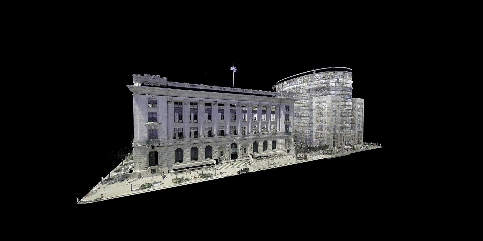
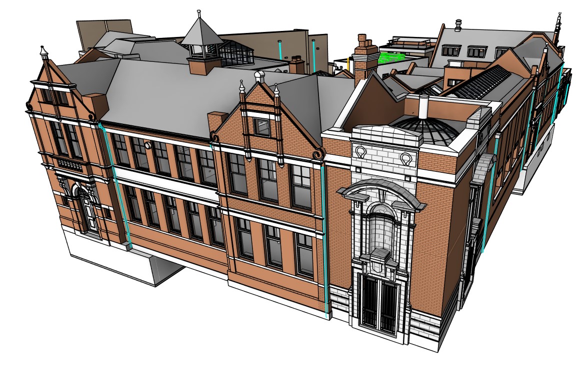
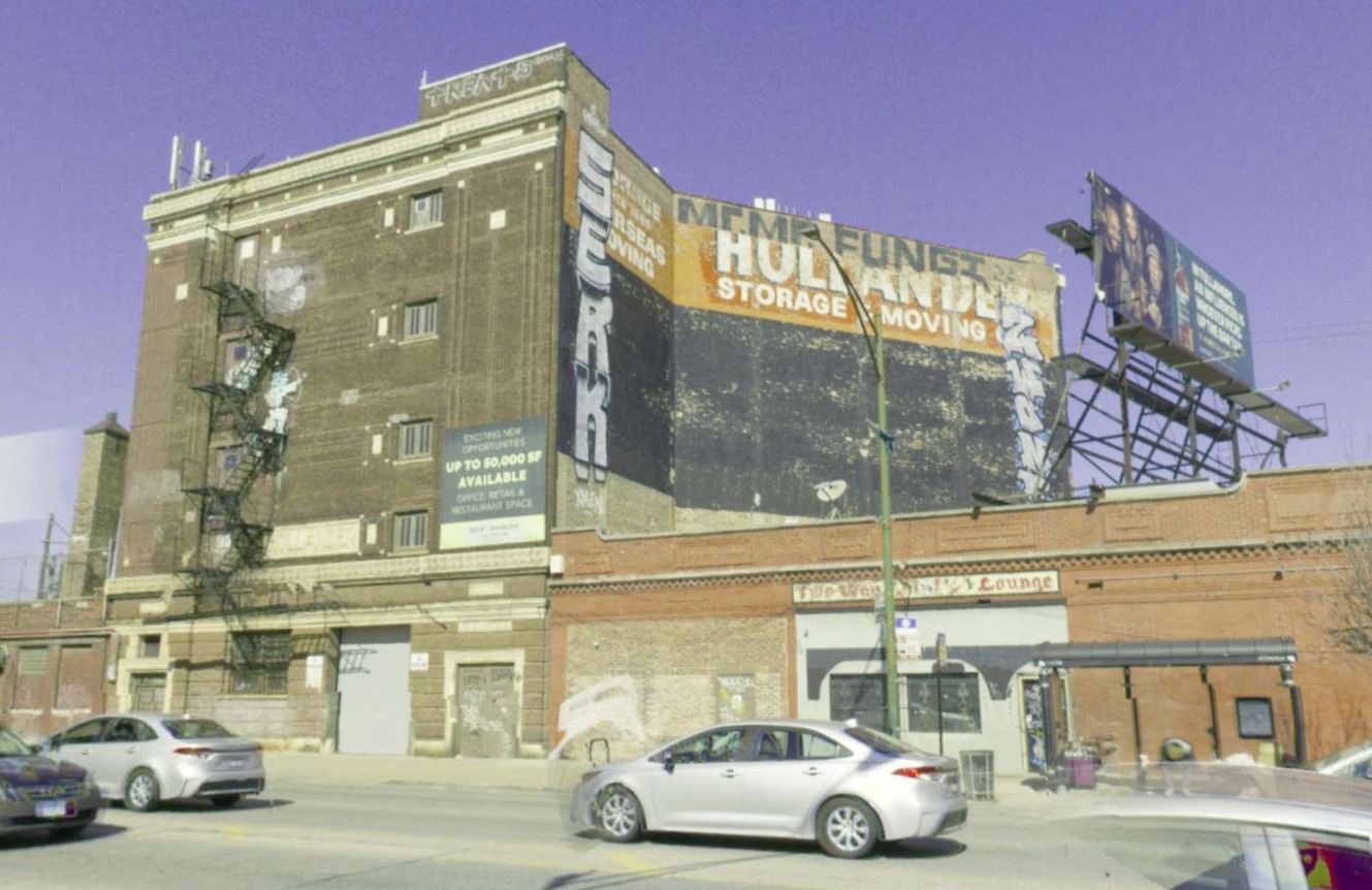
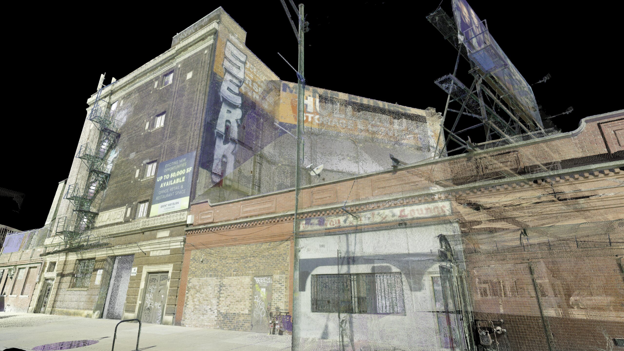
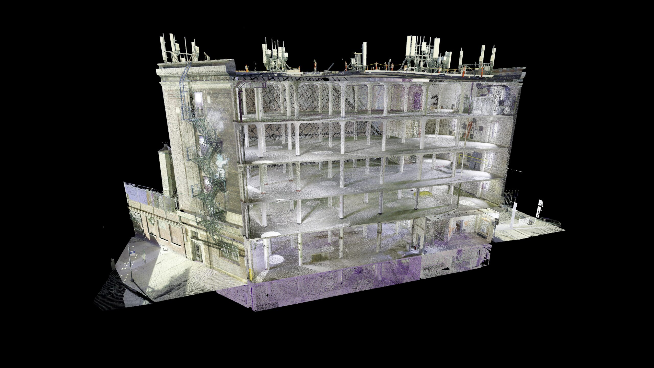
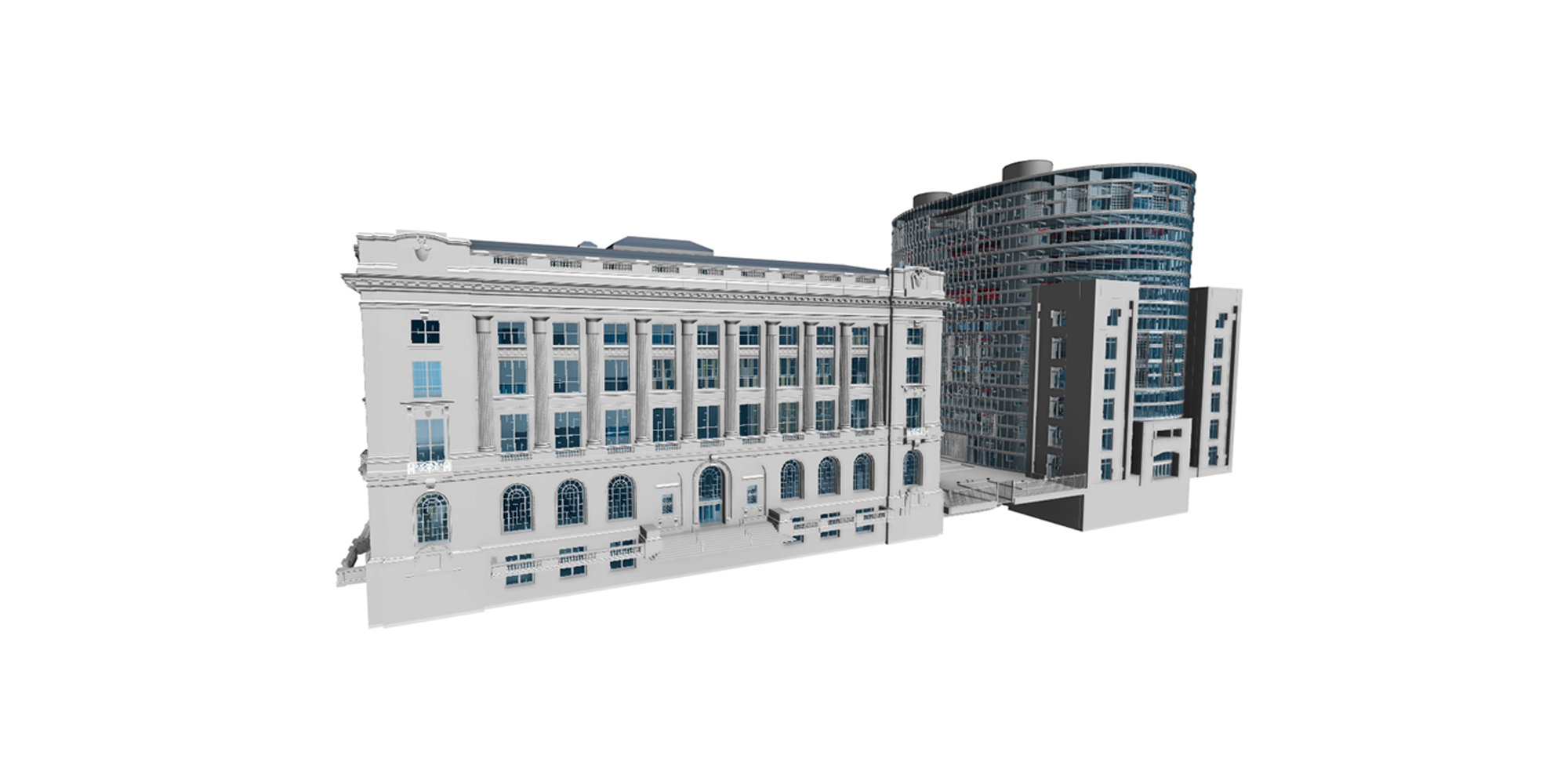
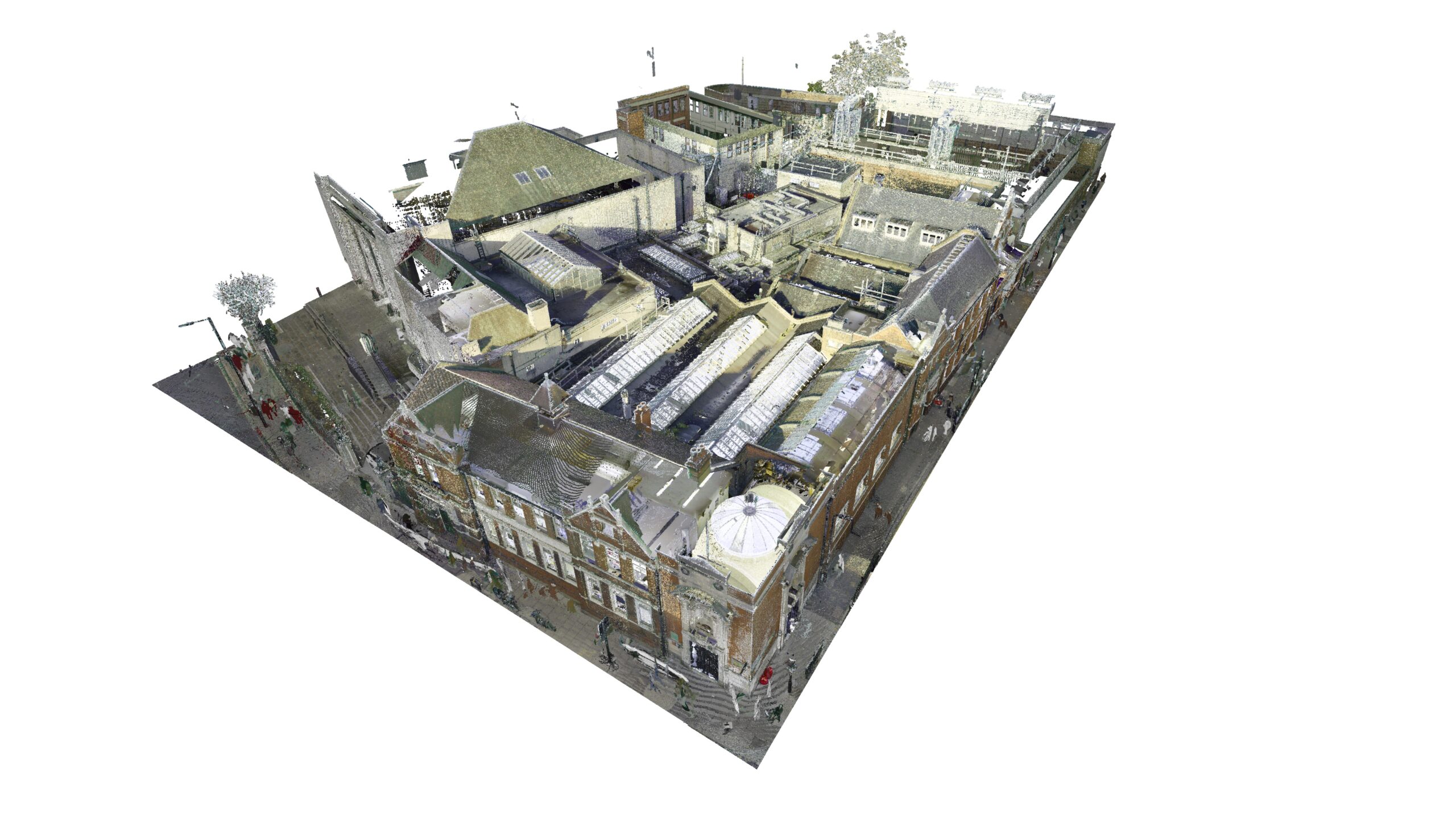
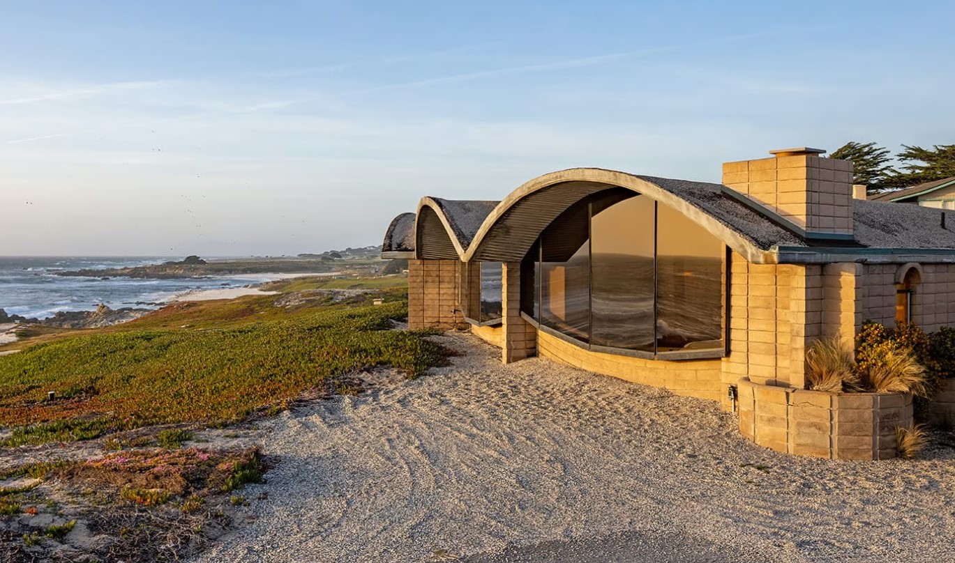
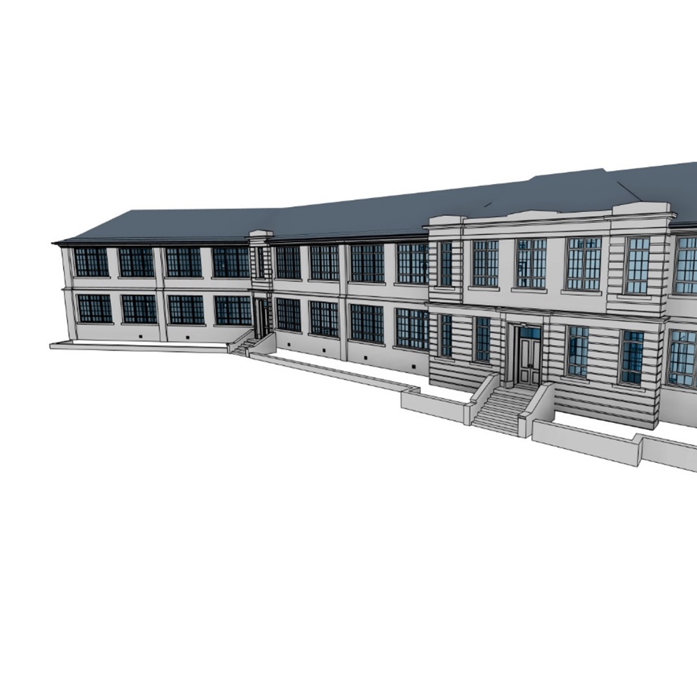
Project Highlights
Hollander Building
Space Architects | 2418 N Milwaukee Ave, Chicago, Illinois
FACILITY RENOVATION
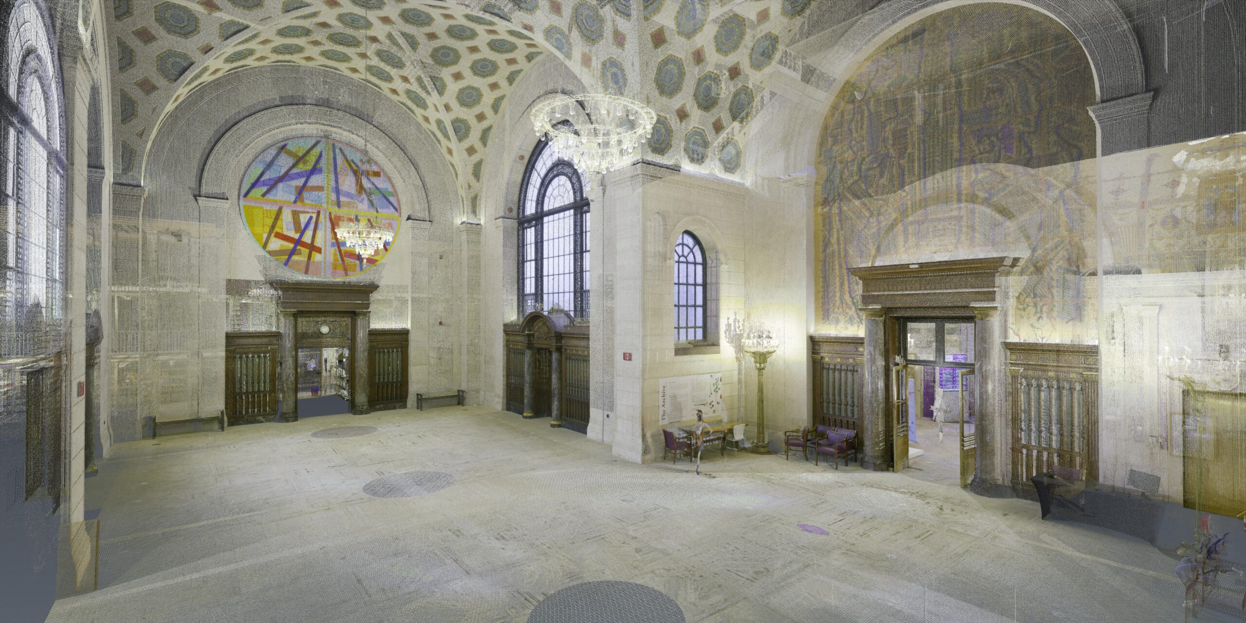
TowerPinkster | Forest Park, Illinois
Main Library & Louis Stokes Wing
Cleveland Public Library | Ohio
Stoke Newington Library
Hackney London Borough Council | London
Fanshell House
Mack5 | Pebble Beach, California
Equans and Southern Housing
Welland Villas | London, United Kingdom
Glashan School
Goodkey, Weedmark & Associates | Ottawa, Canada
Vashon Residence As-Builts
Mutuus Studio | Vashon/Seattle
EnerPHit - Sustainable School Retrofits
Architype | Edinburgh / United Kingdom (Scotland)
University of Newcastle - Railing Design & Installation
Moddex | Newcastle / Australia
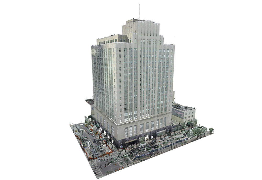
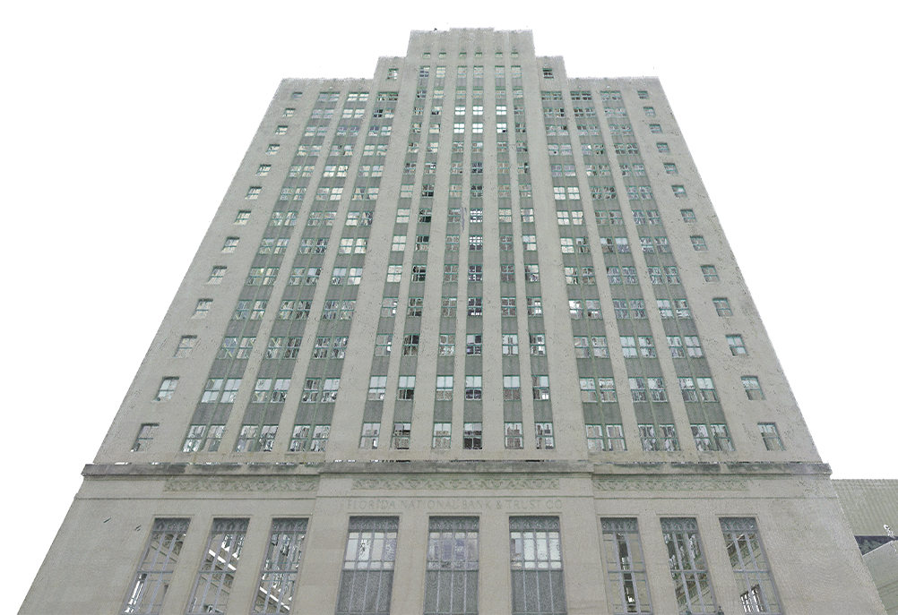
Alfred I Dupont Building
RJ Heisenbottle Architects | Miami / Florida
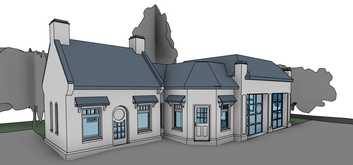
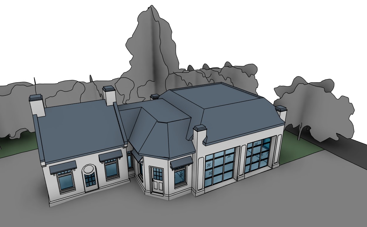
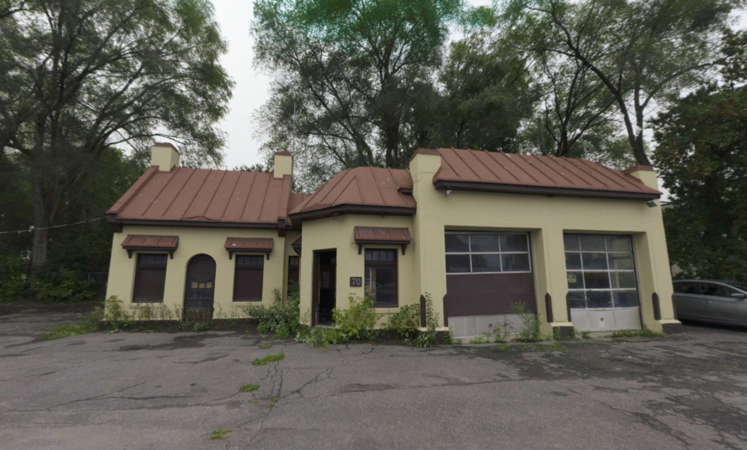
Heritage Gas Station Building/Richmond & Island Park
Trinity Development Group | Ottawa / Canada


OUR COMPETITIVE EDGES


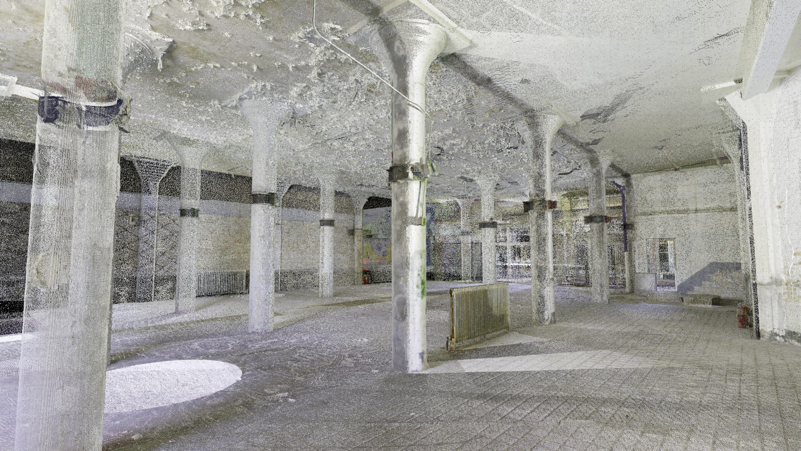
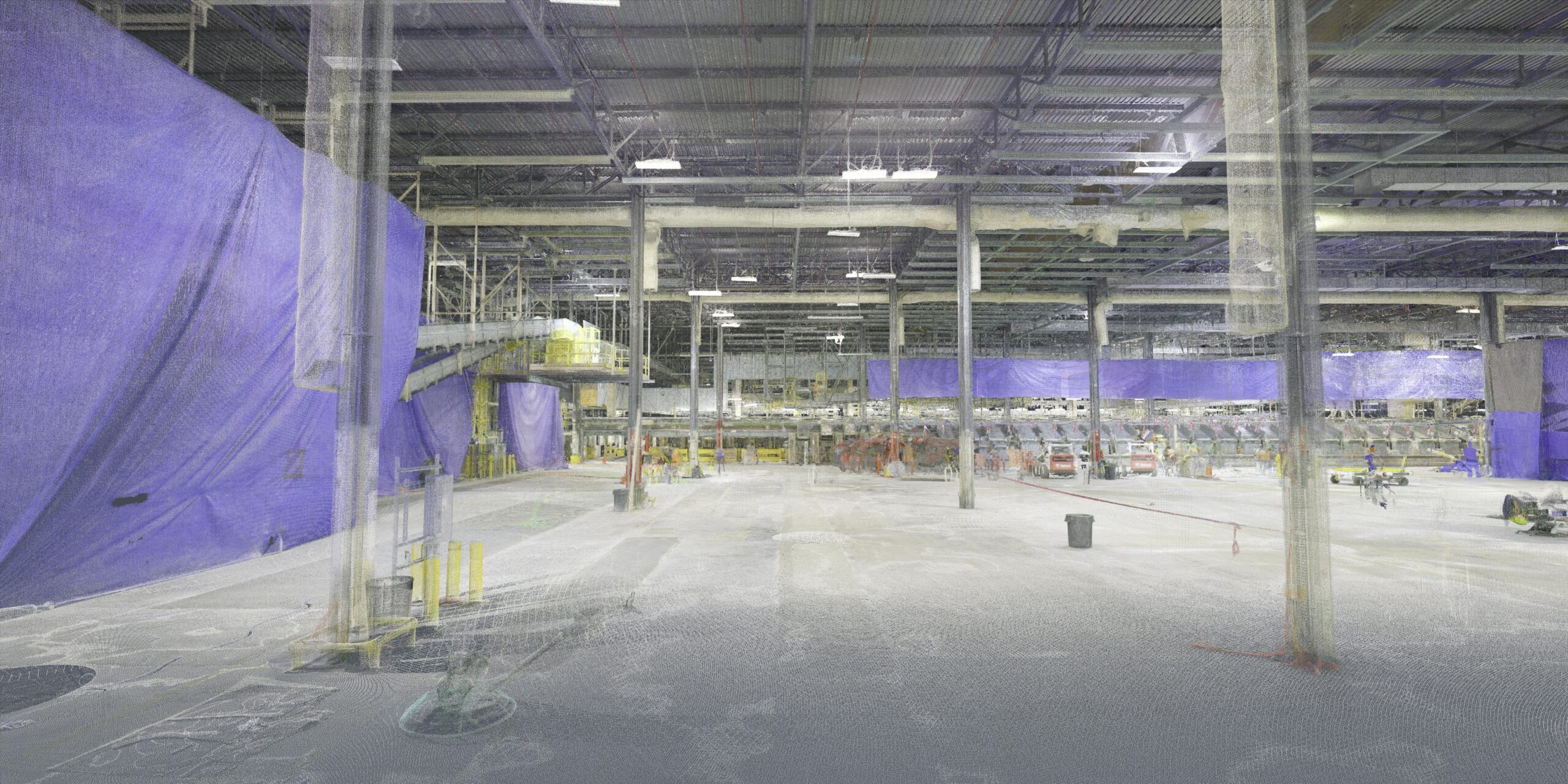
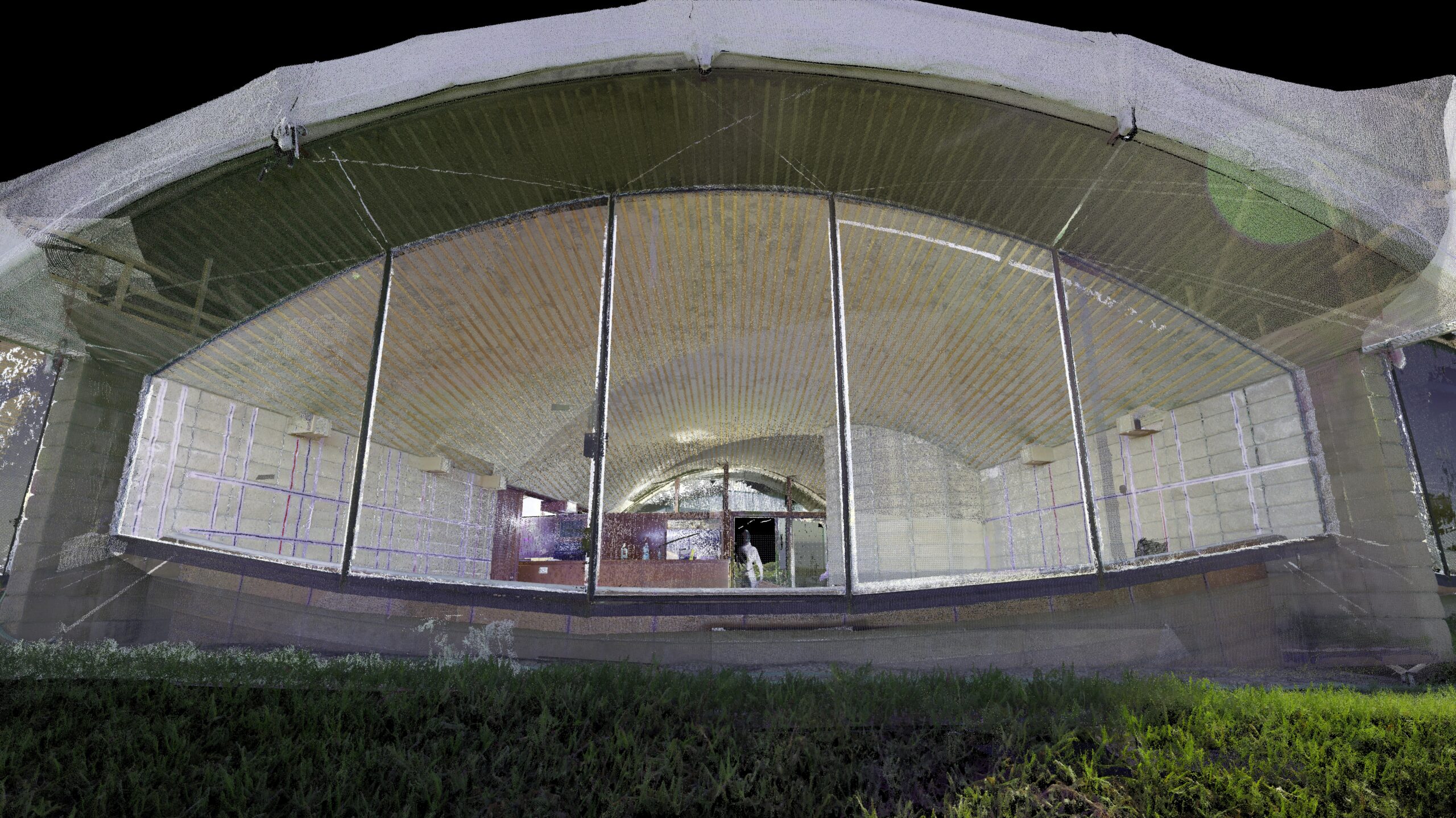
3D Laser Scanning

Utilizing the latest in 3D laser scanning technology from our sister company Leica Geosystems, our 3D scanning service is delivered by local teams, available nationwide and around the globe.
With +150 highly trained reality capture field specialists, Multivista teams can support your projects whether large or small for a variety of purposes. We can provide point cloud data for your renovation project, scan during construction to verify and record as-built conditions or capture existing assets for ongoing facility management and maintenance.
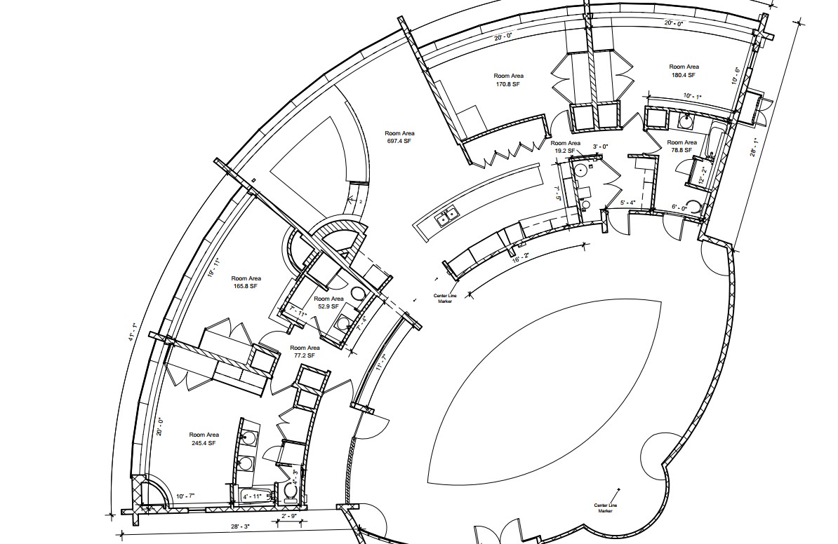
Scan to Plan

Leveraging the accuracy of 3D laser scanning, our scan to services team turns point cloud data into 2D as-built CAD drawings. Based on your requirements Multivista can deliver architectural drawings in Autodesk AutoCAD DWG and DXF format.
- Floor plans
- Ceiling plans
- Building sections
- Roof plans
- Interior & exterior elevations
- Site plans
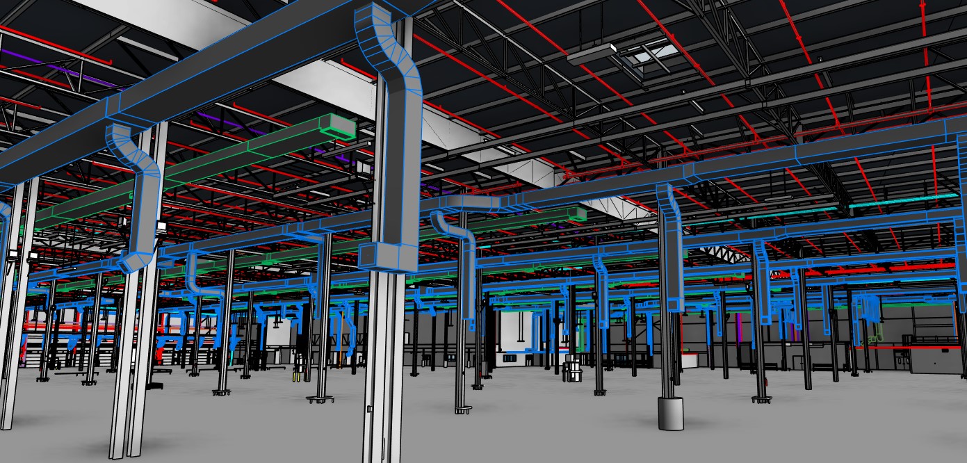
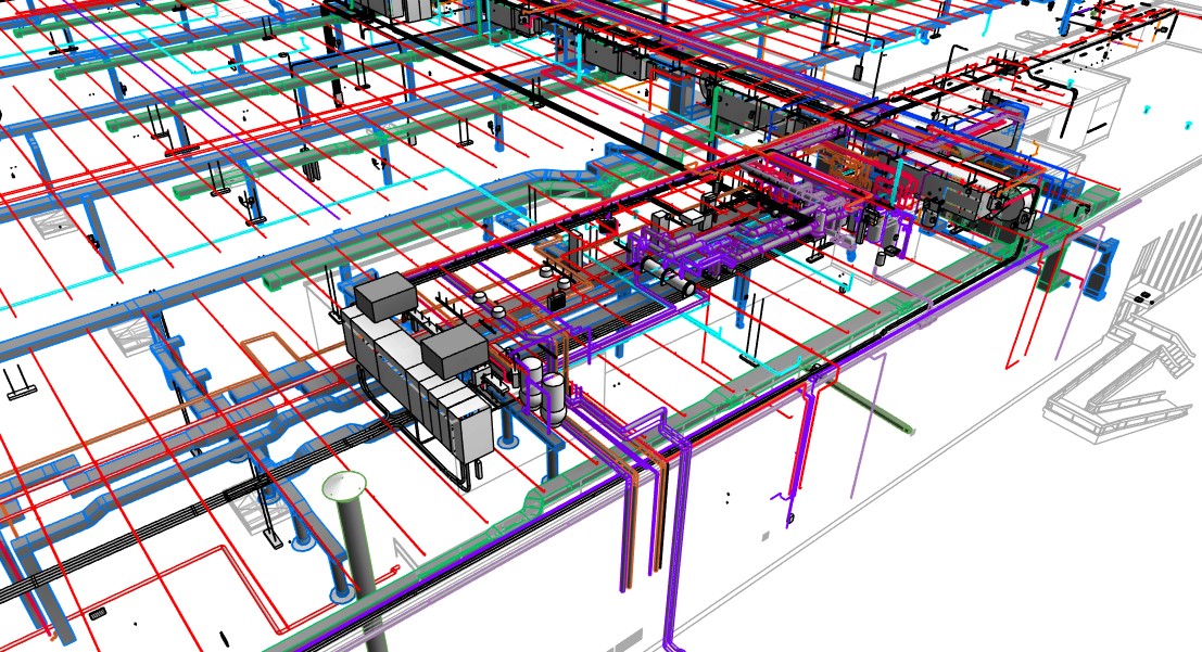
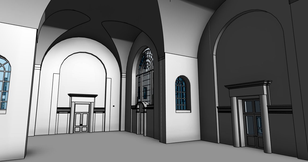
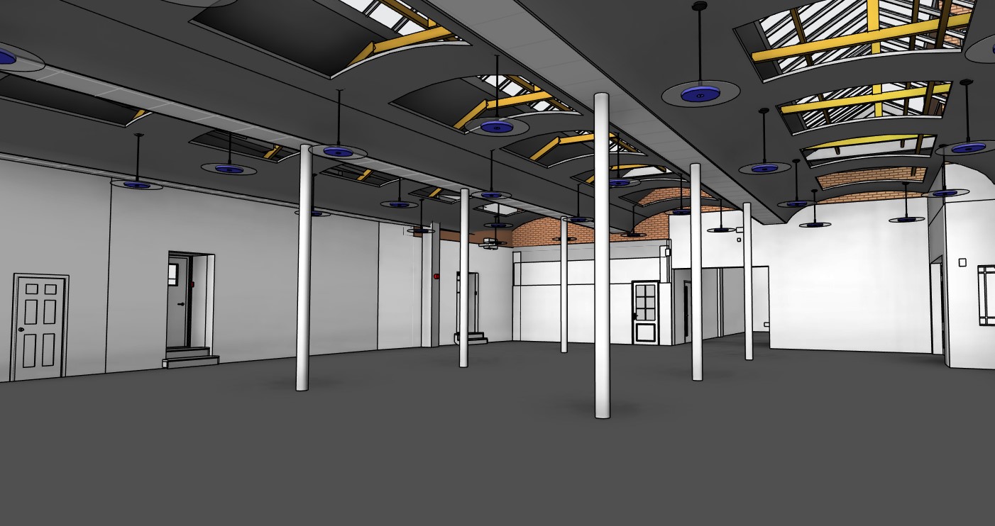
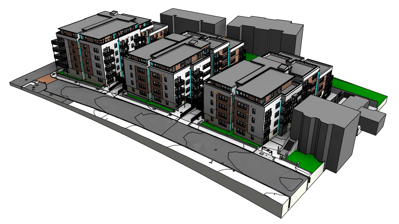
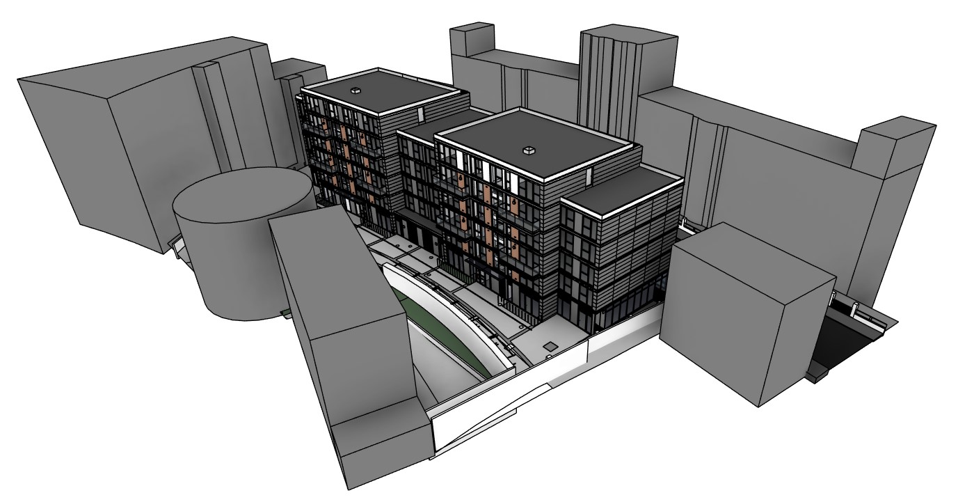
Scan to BIM

We transform your 3D point cloud data into highly accurate 3D Building Information Models (BIM). As-built models are extracted from the captured scan data by our team or qualified Architects and Engineers.
– Architectural Scan to BIM
– Architectural Base Models
– Architectural Add-on packages
– Site Add-on packages
– Mechanical, Electrical and Plumbing (MEP) Scan to BIM
– Mechanical Add-on packages
– Electrical Add-on packages
– Plumbing Add-on packages
Deviation Analysis

Catch costly errors early with Hexagon’s Deviation Analysis. Automatically spot discrepancies between BIM design and reality to avoid rework. With Hexagon’s Deviation Analysis you can share quality insights, ensure accurate as-built models, and keep all stakeholders aligned on your project’s progress.

Floor Flatness Reports

Uneven and unlevel floors cause costly problems during construction. Multivista uses laser scan data and the latest analysis software to generate a PDF heatmap report that visualizes the deformation and contours of the floors surface, to give you visibility of potential problems.
- Manufacturing facilities
- Logistic warehouses
- High-rise & multi-story buildings
- Validation of any types of concrete slabs
VIEW POINT CLOUD DATA ANYWHERE
Share with stakeholders up-to-date, accurate, real-world information on your project through Multivista’s online platform. With the integrated Leica Geosystems TruView technology, take virtual photo-realistic tours of your project site from anywhere, anytime.
In addition, take measurements and annotate critical information, then easily share these details with any stakeholders to improve project collaboration.
How it works

Our +150 scanning professionals use Leica Geosystems scanners to capture precise 3D measurements on site.

Our expert teams process the data to deliver 3D point clouds, 2D CAD drawings, 3D BIM models, and Floor Flatness reports.

Your project teams use these deliverables to shorten timelines, report to stakeholders, get paid faster, and more!
Use Cases

 Healthcare

Hospitals are complex facilities with critical infrastructure and a high density of MEP systems. The accurate documentation and digitization of these complex structures is critical to the success of any construction project or for ongoing facility management system.
Laser scanning provides a fast and non-intrusive method to capture healthcare facilities in precise detail allowing for the creation of accurate CAD drawings or 3D BIM models.
Leverage these deliverables to base design on real-world digital information, avoid costly mistakes from outdated plans or models.
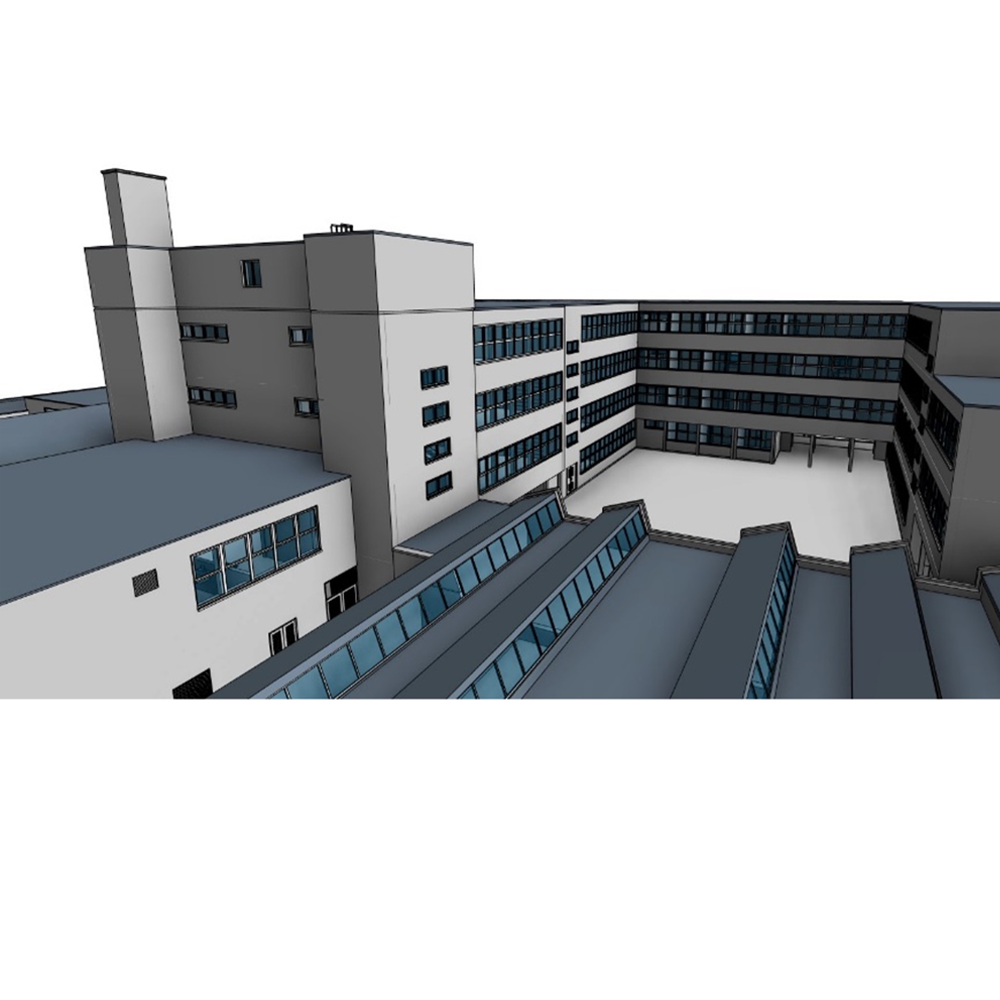
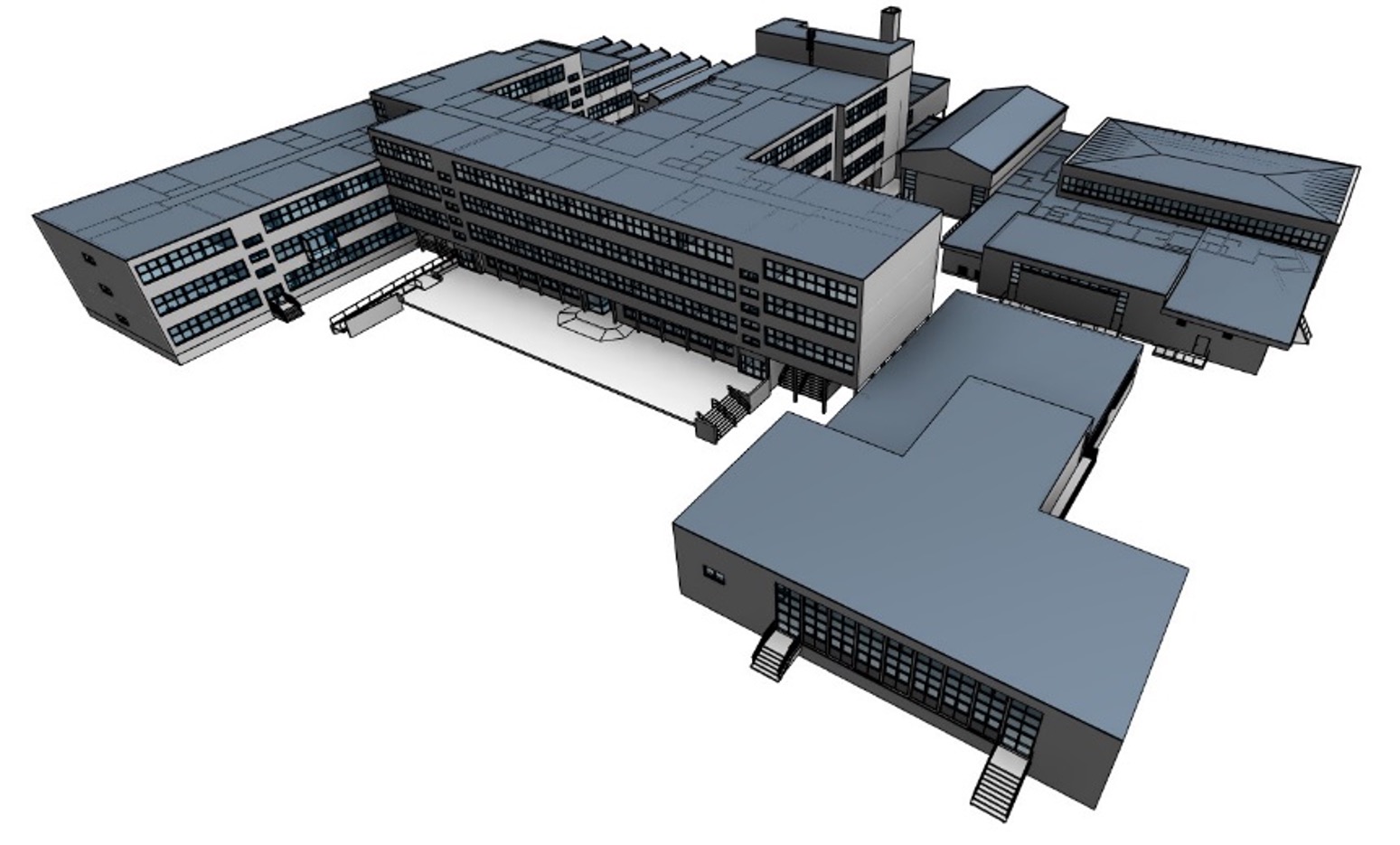
Education

Traditional methods for measuring buildings are time consuming and prone to error. Complex facilities like schools and universities often provide an impossible challenge to capture without the use of a modern 3D laser scanner.
Multivista can quickly scan these spaces in 3D and deliver a complete 3D picture, saving your team hours of time spent on site with measuring tape and clipboard.
The point cloud created by 3D laser scanning can also be linked to a georeferenced coordinate system via survey control, making it simple to visualize how each building on campus relates to the others.
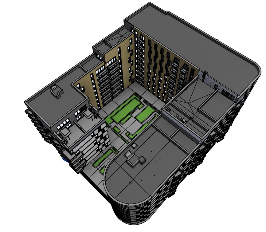
Commercial

Precise 3D footprints are invaluable for both new commercial development and changes to existing structures. Often outdated plans cause costly mistakes which result in downstream project delays. 3D laser scans capture the true as-built situation on site and can be used to assess the impact of costly work before it’s performed, allowing you to propose multiple options for each property.
Trust Multivista to transform your commercial properties into information-rich and easily accessible digital assets with our 3D data capture services.
Residential

Whether a single-family home or a twenty-story tower block the need for accurate as-built documentation to start or finish your project is critical. 3D scanning captures a precise 3D dataset of your projects real-world situation which can be shared to stakeholders throughout the globe via Multivista’s online platform.
Our fully immersive 3D walkthrough connects people to their projects allowing our clients to virtually visit site without leaving their office. Collaborate with colleagues using the high-resolution measurable imagery or download the 2D CAD or 3D BIM model deliverables created by our scan to services teams.
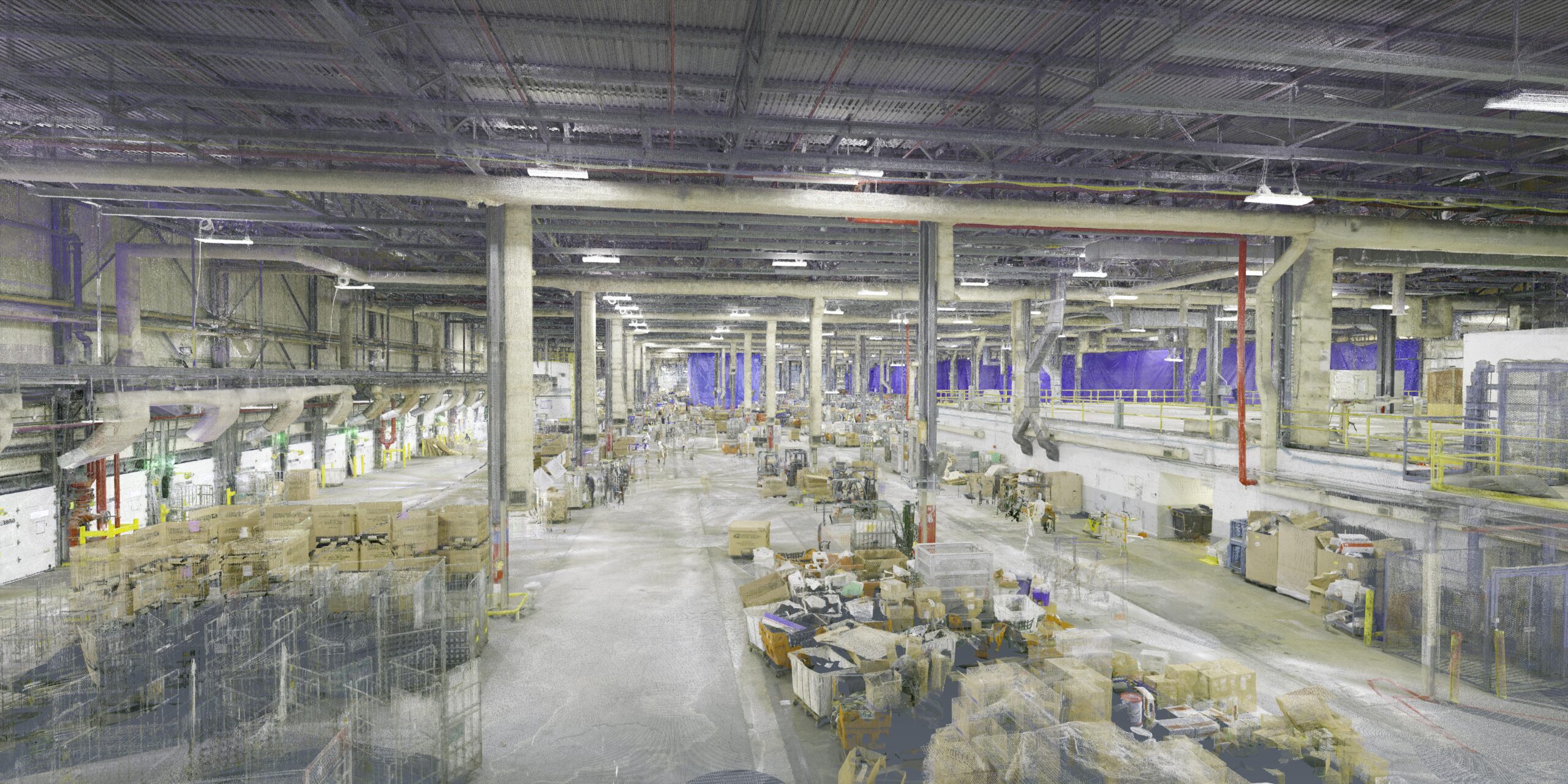
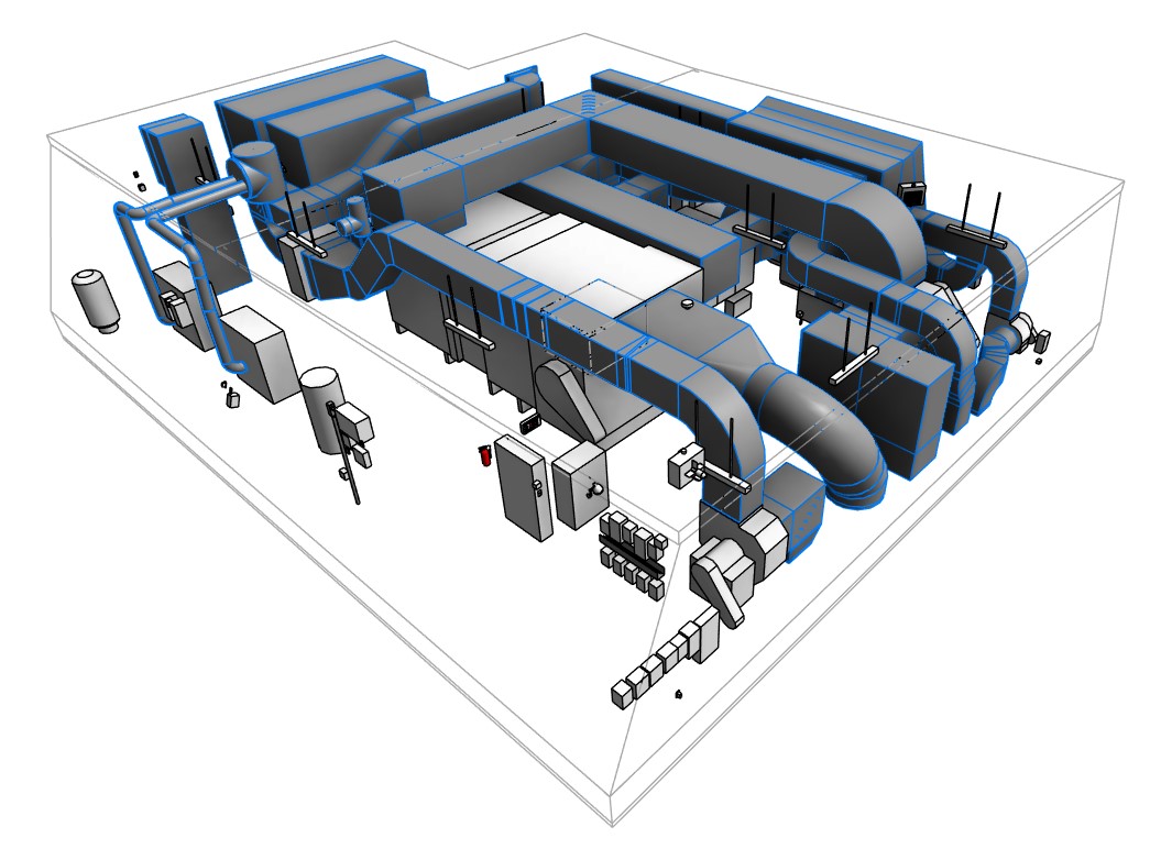
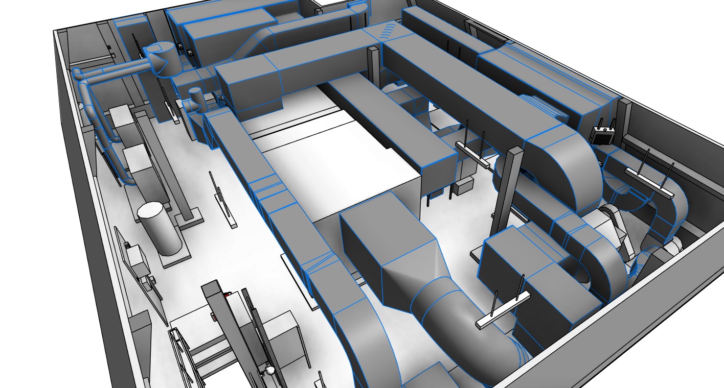
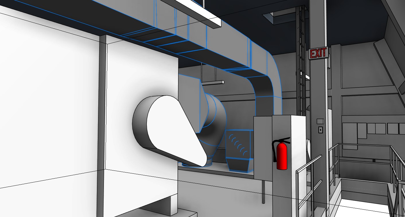
Industrial

Our 3D reality capture professionals collect fast, accurate and dense geospatial data for industrial projects, avoiding potential hazards and limiting disruption to sites and work areas. Our 3D specialists have scanned:
- Water treatment plants
- Telecommunication and data centers
- Manufacturing facilities
- Complex boiler and plant rooms
Once captured our scan to services team will extract accurate 3D models of all the MEP systems and elements visible on site.
Hear from our clients

BCIT has leveraged the Multivista web portal greatly through both this scanning project as well as some live construction webcams we’ve used. It’s very intuitive.
Request a quote
To learn more about our 3D Laser Scanning services, please fill out the form below and someone from our team will be in touch with you shortly.

