Multivista and Matterport join digital innovation initiative to preserve historical property, bring Frank Lloyd Wright’s vision to the world.
Heerbrug, Switzerland and Scottsdale, Ariz. – June 20, 2018 –
Leica Geosystems, part of Hexagon, industry leader in measurement technology, today announced a partnership with the Frank Lloyd Wright Foundation to capture, document, and deliver immersive 3D experiences featuring the iconic architect’s properties.
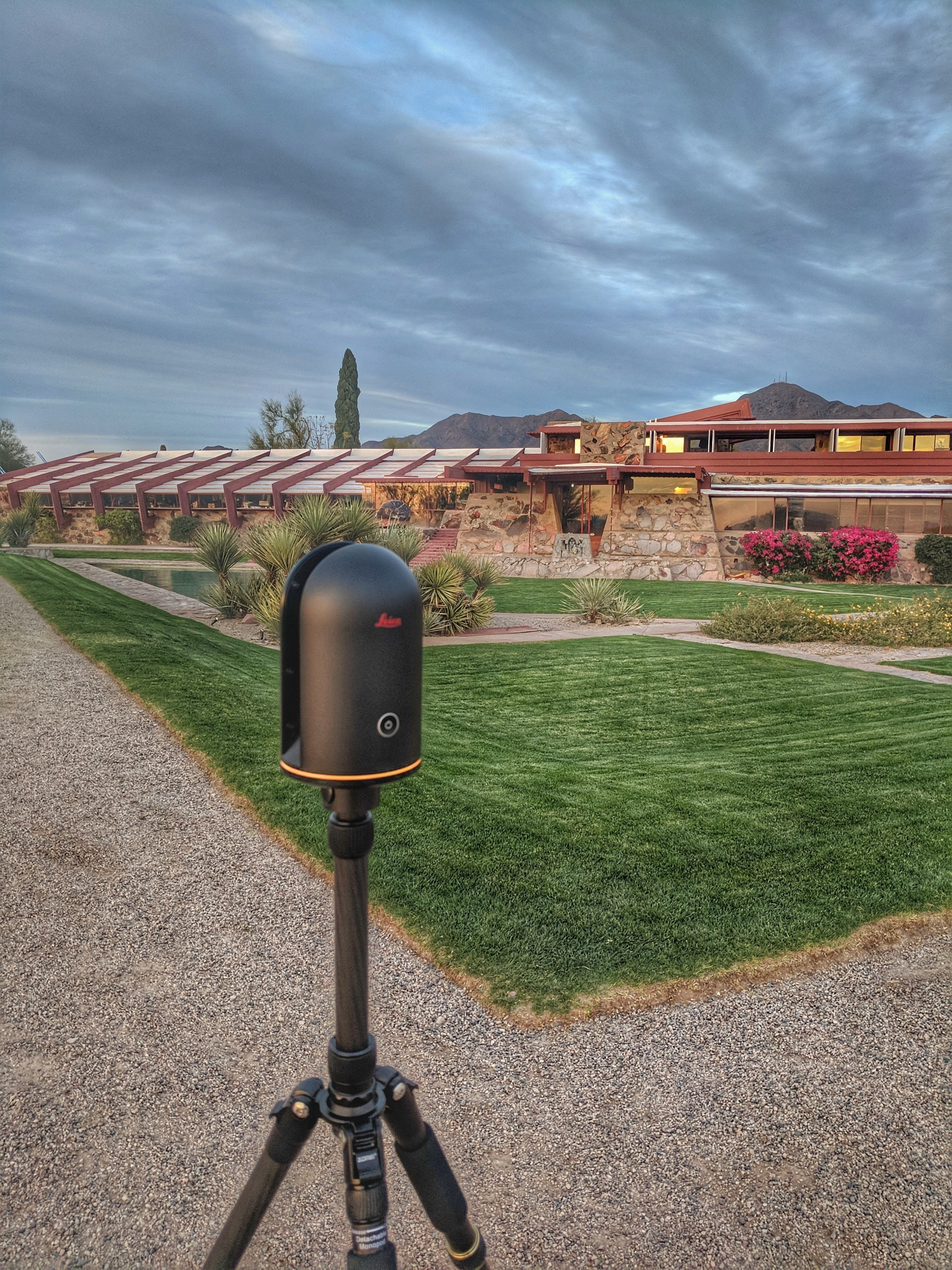
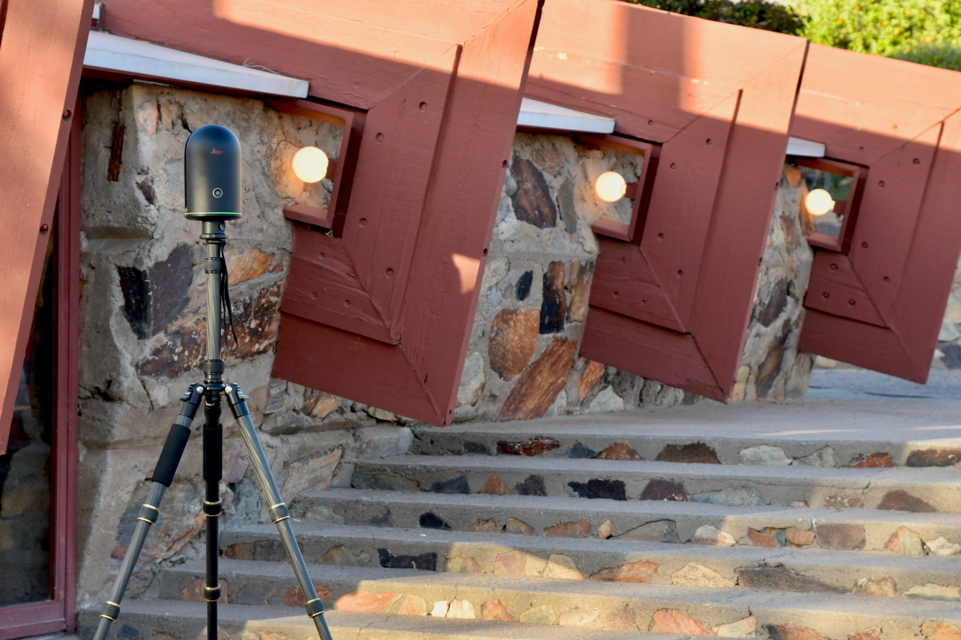
Taliesin West, Frank Lloyd Wright’s winter home and studio, is the first property that will be made available through an immersive online experience led by Leica Geosystems. The Arizona property attracts more than 100,000 tourists each year. Now, the world can explore Taliesin West through an accurate and detailed 3D models of the physical site that will allow viewers to virtually experience the property as if they were actually there.
Leica Geosystems will also capture another property under the Frank Lloyd Wright Foundation Stewardship, Taliesin, which was Frank Lloyd Wright’s Wisconsin home. Leica Geosystems’partnership with the Frank Lloyd Wright Foundation is part of a larger effort by the company to use digital innovation to capture, document and preserve architectural history.
The online Taliesin West experience was created using technology and services from Leica Geosystems, Multivista and Matterport. It goes beyond traditional 3D renderings, documentation, and virtual online tours by capturing the property from every dimension – the exterior grounds and the interior home along with architectural details including 3D views and floorplans.
“True to our mission, the Frank Lloyd Wright Foundation is dedicated to preserving Taliesin and Taliesin West for future generations. Through our partnership with Leica Geosystems, we’re able to carry our mission, and Wright’s vision into the future, by making Taliesin West available to the world so they can experience his ideas, architecture and design in new ways,” said Stuart Graff, president and CEO of the Frank Lloyd Wright Foundation.
Preserving and Sharing Frank Lloyd Wright’s Vision through Technology
The technology that was used to transform Taliesin West into an immersive online experience includes the Leica BLK360, Multivista construction documentation services, and the Matterport 3D cloud platform.
The Leica BLK360 was used to capture the property. It is the world’s smallest, fastest and most simple to use 3D imaging laser scanner. The BLK360 provides the Frank Lloyd Wright Foundation with data in two ways. The first is the 360º spherical imagery that feeds the visual immersive experience. The second comes in the form of a point cloud, a dimensionally accurate laser reproduction of the property that can be used for the Foundation’s preservation efforts. The point cloud can even be loaded in popular CAD and BIM software for highly accurate renovations and careful design changes should the need arise.
Multivista is a global provider of progressive construction documentation and software services and, like Leica Geosystems, is part of Hexagon Geosystems. Multivista provided expert construction documentation services to capture Taliesin West and compile the data.
Leica Geosystems partner Matterport, an immersive 3D media technology company, provided its Matterport Pro2 camera and cloud platform. Matterport makes it easy to create, modify and navigate immersive 3D versions of real-world spaces. Both the BLK360 and the Matterport Pro2 camera feed visual data into the Matterport cloud platform, where the Taliesin West virtual tour is experienced.
“Leica’s history is steeped in engineering and our centuries-long reputation was built on the ability to deliver the most precise tools for measurement and accuracy. As we’ve evolved into the digital age, we bring that rich history and commitment with us as illustrated by our work with the Frank Lloyd Wright Foundation,” said Burkhard Boeckem, CTO of Hexagon’s Geosystems Division. “We look forward to continuing to support the Foundation’s mission and preserving Frank Lloyd Wright’s legacy and bringing his vision forward for the advancement and education of architects and architectural enthusiasts worldwide.”
Take a Virtual Tour of Taliesin West
Designed for architects and architectural enthusiasts, the self-guided virtual tour of Taliesin West delivers unprecedented access to Frank Lloyd Wright’s winter camp and desert laboratory in Arizona. It allows visitors to roam from room-to-room, walk the gardens and zoom in on the expansive collection of sculptures that adorn the property.
Go here to take the immersive Taliesin West experience: franklloydwright.org/3DLAB.
About the Frank Lloyd Wright Foundation
The Frank Lloyd Wright Foundation, established by Wright in 1940, is dedicated to preserving Taliesin and Taliesin West for future generations, and inspiring society through an understanding and experience of Frank Lloyd Wright’s ideas, architecture and design. Wright’s legacy, reflected in contemporary work around sustainable and affordable architecture and excellence in design, is of even greater importance today than in his own time. The Foundation is forward-looking, but rooted in the history of the Taliesin communities. Please visit FrankLloydWright.org for more information on tour schedules, cultural and educational experiences and events.
About Leica Geosystems
Revolutionizing the world of measurement and survey for nearly 200 years, Leica Geosystems creates complete solutions for professionals across the planet. Known for premium products and innovative solution development, professionals in a diverse mix of industries, such as aerospace and defense, safety and security, construction, and manufacturing, trust Leica Geosystems for all their geospatial needs. With precise and accurate instruments, sophisticated software, and trusted services, Leica Geosystems delivers value every day to those shaping the future of our world.
Leica Geosystems is part of Hexagon (Nasdaq Stockholm: HEXA B; hexagon.com), a leading global provider of information technologies that drive quality and productivity improvements across geospatial and industrial enterprise applications.
About Multivista
Multivista is a visual documentation company that has been contracted on over 2.5 billion square feet of construction projects worldwide and is trusted by the industry’s leading companies to mitigate risk, create efficiencies, and deliver a higher level of project insight throughout a building’s lifecycle. Multivista offers a full suite of visual documentation services with local boots-on-the-ground support in over 75 international markets. Along with streaming webcams, professional facility management videos, virtual walkthroughs, and UAVs, Multivista delivers interactive as-builts by linking inspection-grade visual documentation to architectural plans to capture every project with exceptional clarity.
Multivista is part of Hexagon (Nasdaq Stockholm: HEXA B; hexagon.com), a leading global provider of information technologies that drive quality and productivity improvements across geospatial and industrial enterprise applications.
 hbspt.cta.load(2621692, ‘0d0aa529-9f49-4808-a625-16ea185a18f0’, {});